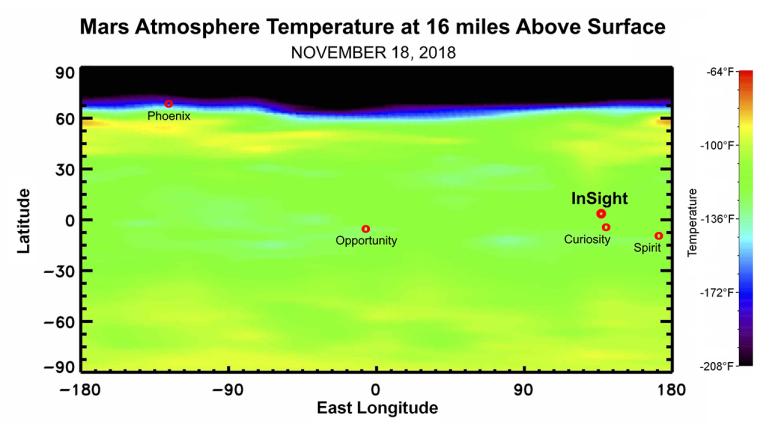
This map shows the temperature of the Martian atmosphere 16 miles above the surface. The data were taken on Nov. 18, 2018, by NASA's Mars Reconnaissance Orbiter, about one week before NASA's InSight lander is scheduled to touch down on the Martian surface. The temperature indicates to mission scientists the amount of dust activity in the atmosphere. The map shows a range of latitudes, with temperatures clearly dropping near the planet's north pole. The landing locations of various NASA Mars landers are shown for context.
The data used to generate the map come from the Mars Climate Sounder instrument on MRO.
NASA's Jet Propulsion Laboratory, a division of Caltech in Pasadena, California, manages the Mars Reconnaissance Orbiter Project for NASA's Science Mission Directorate, Washington, and leads the Mars Climate Sounder investigation.