Map Projected Browse Image
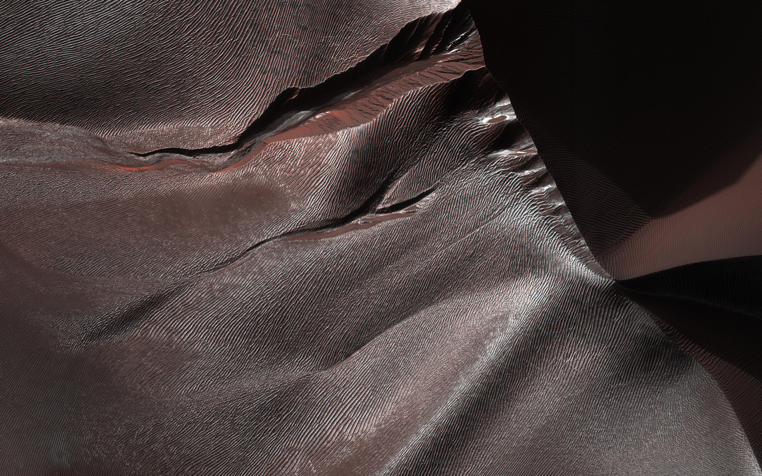
Click on the image for larger versionGullies on Martian sand dunes, like these in Matara Crater, have been very active, with many flows in the last ten years. The flows typically occur when seasonal frost is present.
In this image from NASA's Mars Reconnaissance Orbiter we see frost in and around two gullies, which have both been active before. (View this observation to see what these gullies looked like in 2010.) There are no fresh flows so far this year, but HiRISE will keep watching.
The map is projected here at a scale of 50 centimeters (19.7 inches) per pixel. [The original image scale is 50.3 centimeters (19.8 inches) per pixel (with 2 x 2 binning); objects on the order of 151 centimeters (59.4 inches) across are resolved.] North is up.
The University of Arizona, Tucson, operates HiRISE, which was built by Ball Aerospace & Technologies Corp., Boulder, Colorado. NASA's Jet Propulsion Laboratory, a division of Caltech in Pasadena, California, manages the Mars Reconnaissance Orbiter Project for NASA's Science Mission Directorate, Washington.

