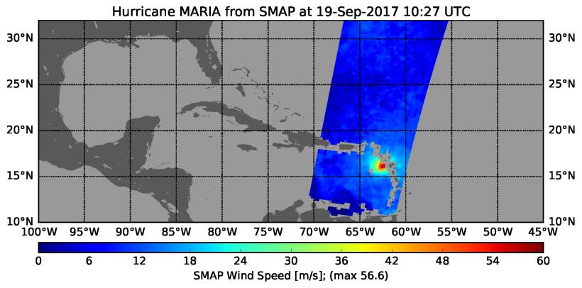
The radiometer instrument on NASA's Soil Moisture Active Passive (SMAP) spacecraft captured this image of Hurricane Maria at 6:27 a.m. EDT on Sept. 19, 2017 (10:27 UTC), showing an estimated maximum surface wind speed of 126.6 miles per hour (56.6 meters per second). While Maria was already a Category 5 hurricane at the time of this observation, it is an extremely tightly organized hurricane and SMAP cannot fully resolve its highest winds due to the 25-mile (40-kilometer) resolution of SMAP.
SMAP is managed for NASA's Science Mission Directorate by NASA's Jet Propulsion Laboratory in Pasadena, California, and NASA's Goddard Space Flight Center in Greenbelt, Maryland. JPL is managed for NASA by Caltech. A consortium of researchers from other universities participate on the SMAP mission science team, including the Massachusetts Institute of Technology, Princeton University and the University of Montana, which provided the SMAP surface water imagery.
For more information about SMAP, visit http://smap.jpl.nasa.gov.