
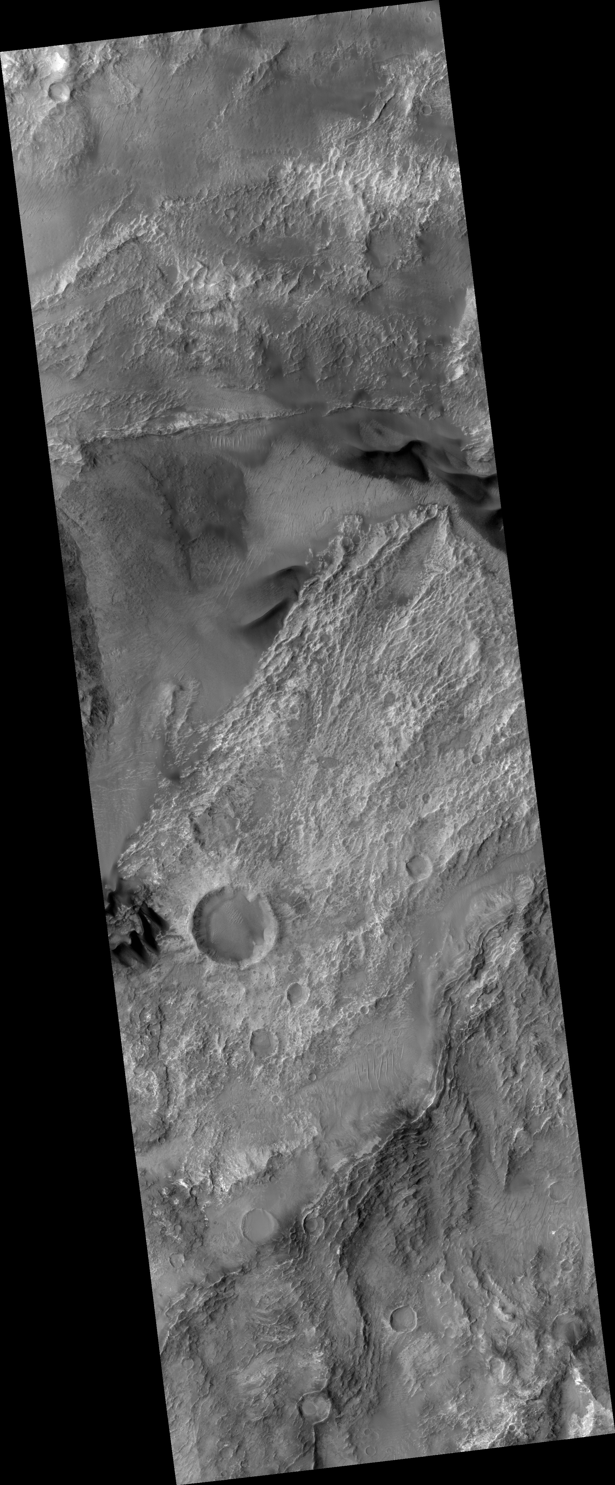
Map Projected Browse Image
Click on the image for larger versionThis image captured by NASA's Mars Reconnaissance Orbiter (MRO) covers diverse surface units on the floor of eastern Coprates Chasma in eastern Valles Marineris.
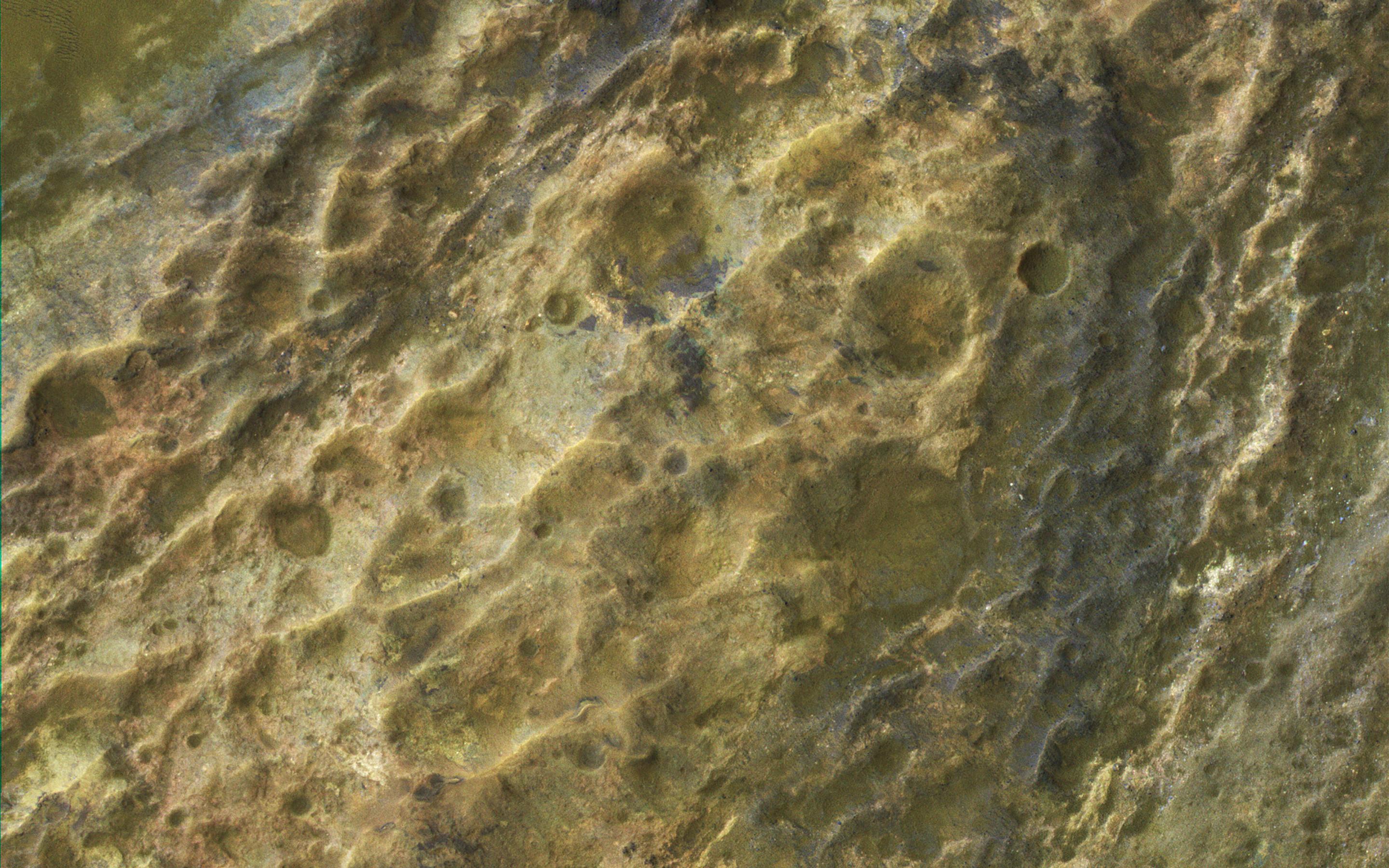
The bedrock has diverse minerals producing wonderful color contrasts. In over 10 years of orbiting Mars, HiRISE has acquired nearly 50,000 large images, but they cover less than 3 percent of the Martian surface.
The map is projected here at a scale of 50 centimeters (19.7 inches) per pixel. [The original image scale is 53.1 centimeters (20.9 inches) per pixel (with 2 x 2 binning); objects on the order of 159 centimeters (62.6 inches) across are resolved.] North is up.
The University of Arizona, Tucson, operates HiRISE, which was built by Ball Aerospace & Technologies Corp., Boulder, Colo. NASA's Jet Propulsion Laboratory, a division of Caltech in Pasadena, California, manages the Mars Reconnaissance Orbiter Project for NASA's Science Mission Directorate, Washington.
