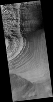
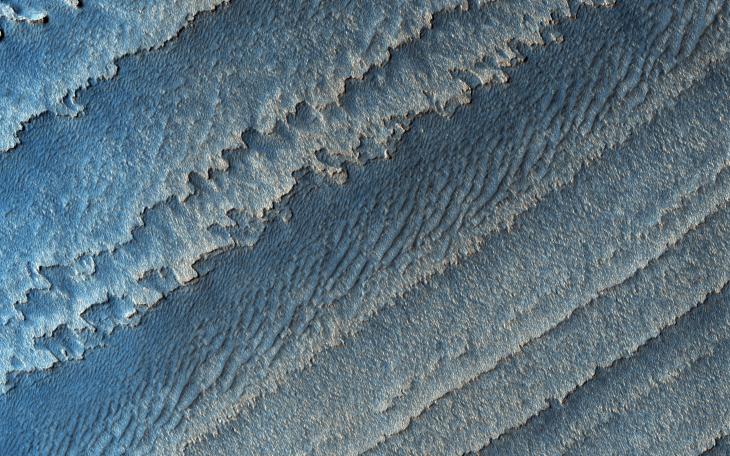
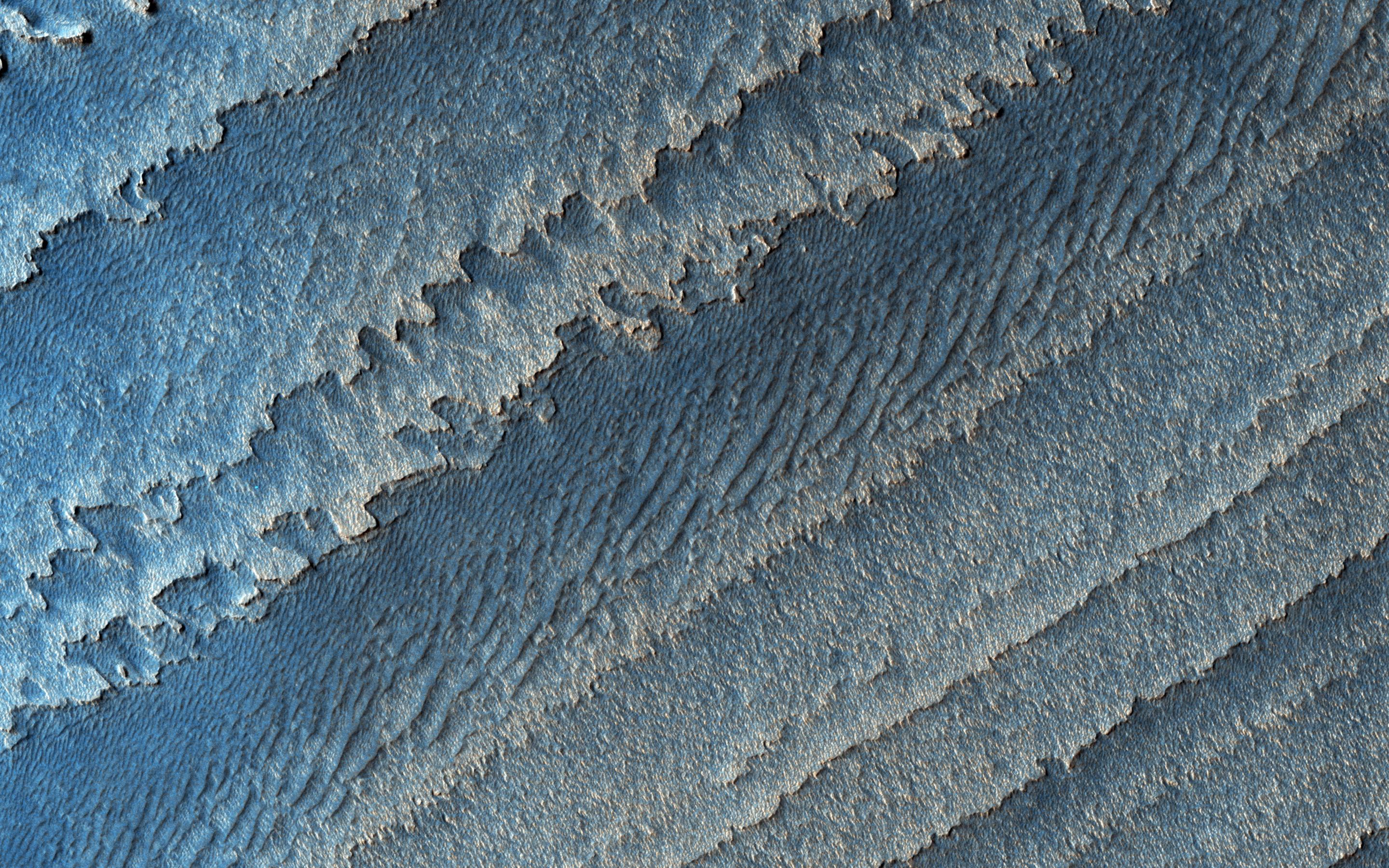
Map Projected Browse Image
Click on the image for larger versionThis image shows a layered deposit in Galle Crater, located in the Southern cratered highlands.
The geologic history of Galle Crater is not well constrained, and it contains a variety of features that have been interpreted as fluvial, lacustrine or glacial deposits.
The deposit pictured here contains multiple unconformities (sudden or irregular changes from one deposit to another), indicating periods of erosion and non deposition.
The map is projected here at a scale of 25 centimeters (9.8 inches) per pixel. [The original image scale is 25.7 centimeters (10.1 inches) per pixel (with 1 x 1 binning); objects on the order of 77 centimeters (30.3 inches) across are resolved.] North is up.
This is a stereo pair with PSP_003934_1275.
The University of Arizona, Tucson, operates HiRISE, which was built by Ball Aerospace & Technologies Corp., Boulder, Colo. NASA's Jet Propulsion Laboratory, a division of Caltech in Pasadena, California, manages the Mars Reconnaissance Orbiter Project for NASA's Science Mission Directorate, Washington.
