PDS logoPlanetary Data System
PDS Information
Find a Node - Use these links to navigate to any of the 8 publicly accessible PDS Nodes.

This bar indicates that you are within the PDS enterprise which includes 6 science discipline nodes and 2 support nodes which are overseen by the Project Management Office at NASA's Goddard Space Flight Center (GSFC). Each node is led by an expert in the subject discipline, supported by an advisory group of other practitioners of that discipline, and subject to selection and approval under a regular NASA Research Announcement.
Click here to return to the Photojournal Home Page Click here to view a list of Photojournal Image Galleries Photojournal_inner_header
Latest Images  |  Spacecraft & Technology  |  Animations  |  Space Images App  |  Feedback  |  Photojournal Search  

PIA21266: 'Wing' Dike of Hardened Lava in New Mexico
 Target Name:  Earth
 Is a satellite of:  Sol (our sun)
 Mission:  Mars Reconnaissance Orbiter (MRO)
 Product Size:  4608 x 3456 pixels (w x h)
 Produced By:  JPL
 Full-Res TIFF:  PIA21266.tif (39.07 MB)
 Full-Res JPEG:  PIA21266.jpg (1.569 MB)

Click on the image above to download a moderately sized image in JPEG format (possibly reduced in size from original)

Original Caption Released with Image:

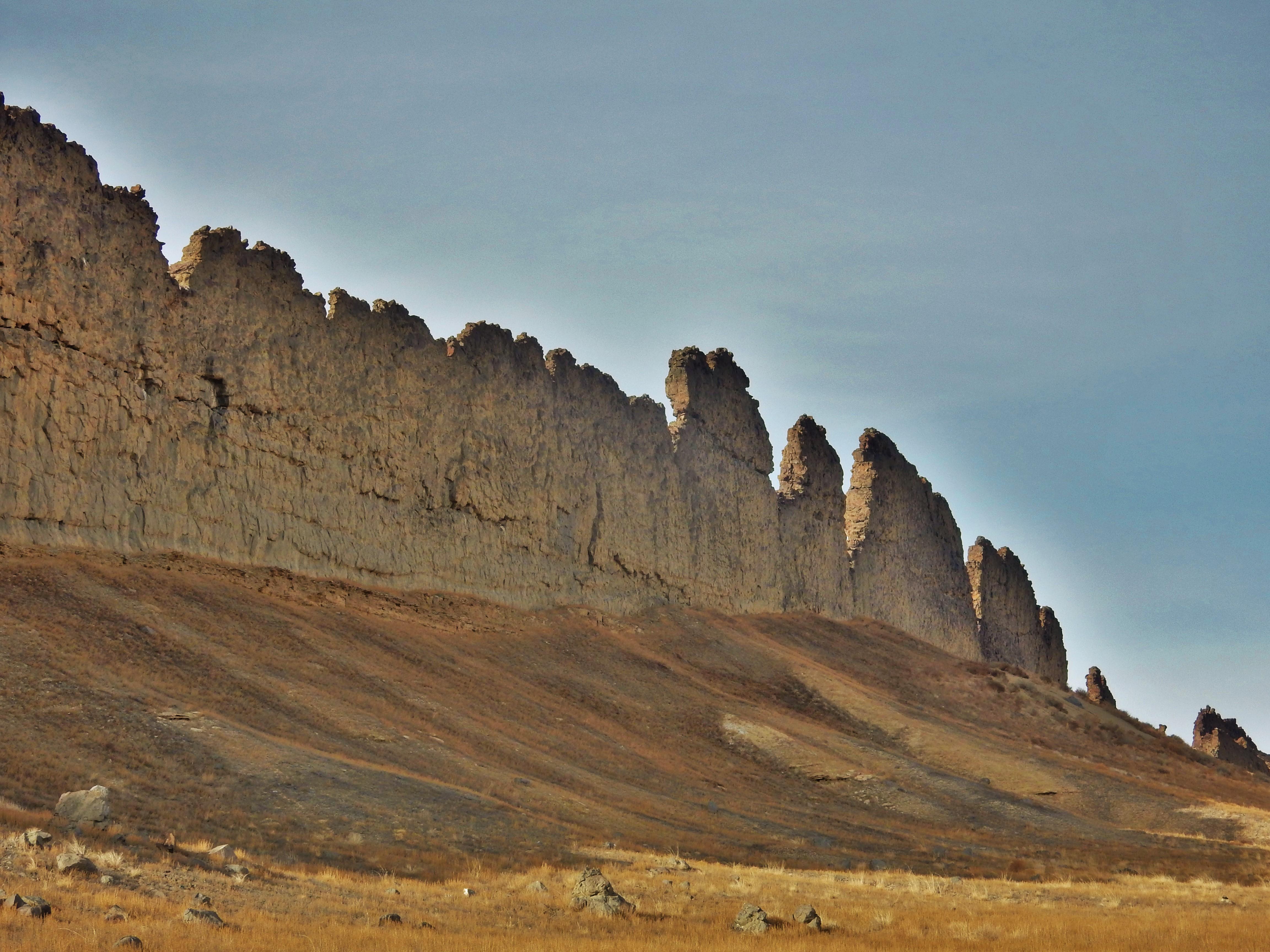
This photograph from northwestern New Mexico shows a ridge roughly 30 feet (about 10 meters) tall that formed from lava filling an underground fracture then resisting erosion better than the material around it did.

The dike extends from a volcanic peak (out of view here) called Shiprock in English and Tsé Bit'a'í, meaning "rock with wings," in the Navajo language. It offers an Earth analog for some larger hardened-lava walls on Mars, shown at PIA21264.

Image Credit:
NASA/JPL-Caltech

Image Addition Date:
2017-01-25