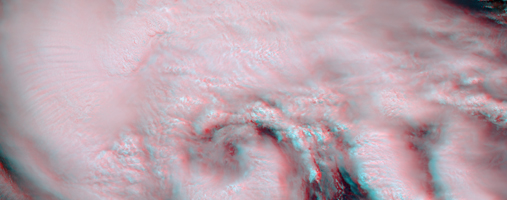
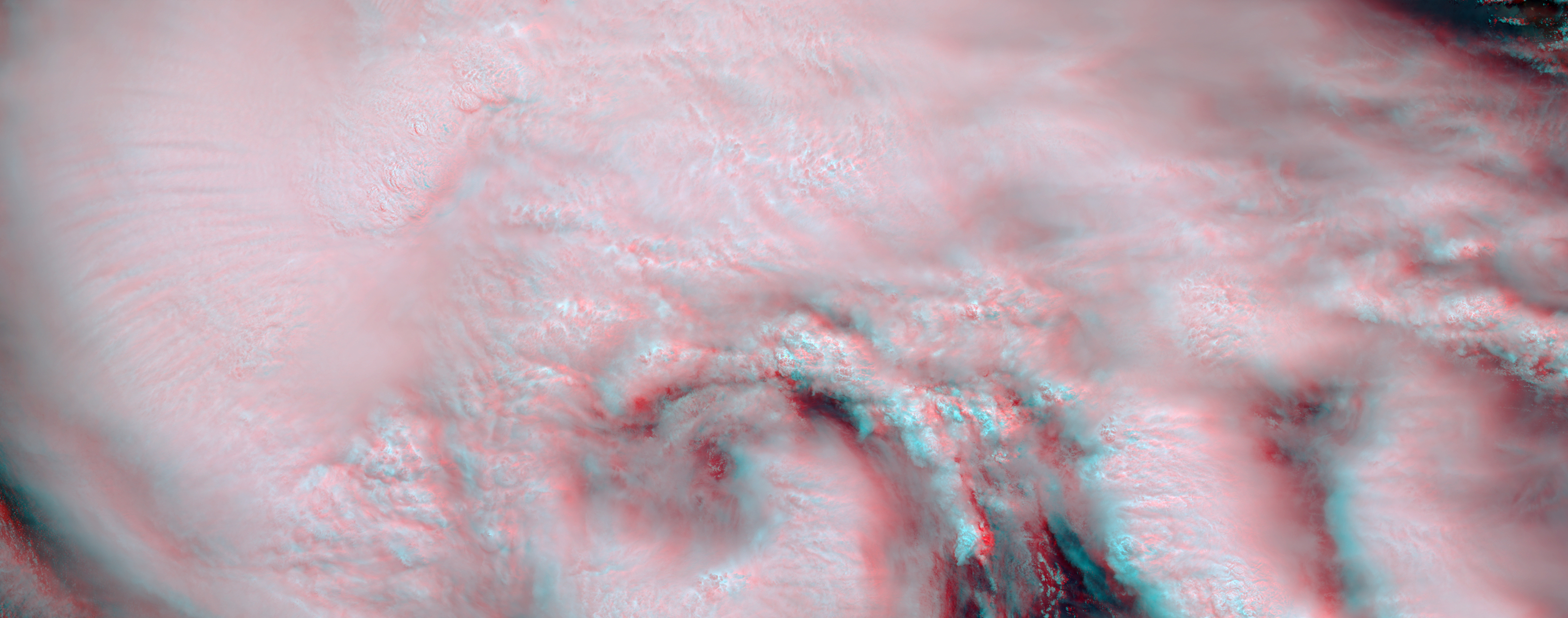
Anaglyph
Click on the image for larger view
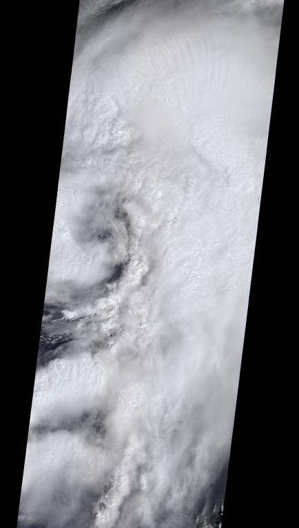
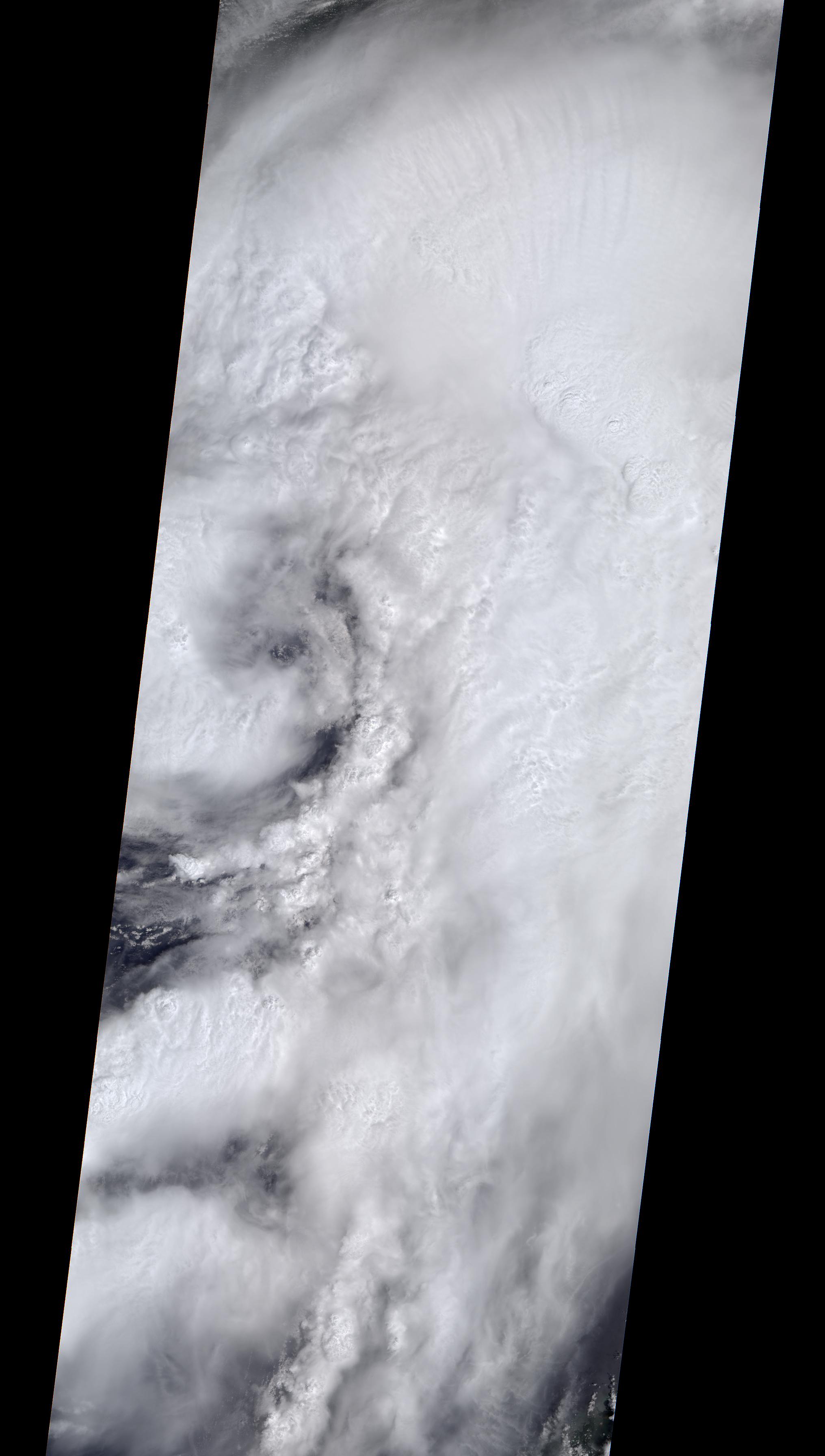
Download the full resolution TIFF fileOn the afternoon of Sept. 1, 2016, Tropical Storm Hermine strengthened into a Category 1 hurricane as it approached the coast of Florida. Hermine began life as Tropical Depression Nine, originating off the coast of Cuba on Aug. 28. After heading northwest into the Gulf of Mexico, it took a right turn toward Florida and on Wednesday, Aug. 31, was upgraded to a tropical storm before strengthening to a hurricane a day later. Winds are currently sustained near 75 miles (121 kilometers) per hour, and the storm is expected to make landfall tonight or early tomorrow. Florida Governor Rick Scott has declared a state of emergency in 51 counties, while Georgia Governor Nathan Deal has done the same for 56 counties in his state. Localized flooding is already occurring in some areas of Florida, which has not had a direct landfall by a hurricane in 11 years. After moving across Florida and Georgia, the storm is currently forecast to continue northward along the coast of the Eastern seaboard.
On Sept. 1, at 12:30 p.m. EDT, the Multi-angle Imaging SpectroRadiometer (MISR) instrument aboard NASA's Terra spacecraft passed over the area. This natural-color image from MISR's vertical-pointing camera shows the large, loosely organized hurricane. At the time, the center of the storm was located about 200 miles (325 kilometers) to the west of Sarasota on the Florida coast. The image is 235 miles (378 kilometers) in width. Also included is a 3D stereo anaglyph, made by combining data from MISR's vertical-pointing and 46-degree forward-pointing camera. The image has been rotated so that north is to the left in order to enable stereo viewing. With the aid of red-blue glasses (with the red lens over the left eye), it is possible to observe the storm in three dimensions. Note the towering central thunderstorms around the eye in comparison to the low clouds visible within it.
These data were acquired during Terra orbit 88865. Other MISR data are available through the NASA Langley Research Center; for more information go to http://eosweb.larc.nasa.gov/project/misr/misr_table. MISR was built and is managed by NASA's Jet Propulsion Laboratory, Pasadena, California, for NASA's Science Mission Directorate, Washington, D.C. The Terra spacecraft is managed by NASA's Goddard Space Flight Center, Greenbelt, Maryland. The MISR data were obtained from the NASA Langley Research Center Atmospheric Science Data Center, Hampton, Virginia. JPL is a division of the California Institute of Technology in Pasadena.