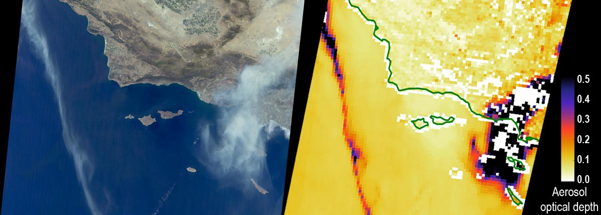
The Sand Fire in the Santa Clarita Valley area of Southern California erupted on Friday, July 22, 2016, and rapidly grew to more than 37,000 acres (58 square miles, or 150 square kilometers) over the weekend. As of Tuesday, July 26, hundreds of residents still remain under evacuation orders, and the fire claimed the life of a local resident. The fire is currently 25 percent contained. The Multi-angle Imaging SpectroRadiometer (MISR) instrument aboard NASA's Terra satellite passed over the region on July 23 around 11:50 a.m. PDT. At left is an image acquired by MISR's 60-degree forward-viewing camera. The oblique view angle makes the smoke more apparent than it would be in a more conventional vertical view. Smoke from the Sand Fire is visible on the right-hand side of the image, and a long streamer of smoke from the Soberanes Fire near Big Sur in Central California is visible over the ocean near the left-hand side of the image. Like the Sand Fire, the Soberanes Fire also broke out on July 22, and quickly grew to more than 19,000 acres (30 square miles, or 77 square kilometers), causing the evacuation of hundreds of people and closure of several state parks. The Soberanes Fire is currently only 10 percent contained. The swath width of the MISR image is 257 miles (414 kilometers).
At right is a map of aerosol optical depth, a quantitative measure of the smoke abundance in the atmosphere, derived from the images acquired by MISR's nine differently angled cameras. The thick smoke from both fires is apparent. Individual squares making up this map measure 2.7 miles (4.4 kilometers) on a side. The product shown here is a prototype of a new version of the MISR aerosol product to be publicly released in the near future, and increases the spatial resolution of the aerosol information by a factor of 16 compared to the currently available product, making it possible to discern finer details in the distribution of the smoke.
These data were captured during Terra orbit 88284. MISR was built and is managed by NASA's Jet Propulsion Laboratory, Pasadena, California, for NASA's Science Mission Directorate, Washington, D.C. The Terra spacecraft is managed by NASA's Goddard Space Flight Center, Greenbelt, Maryland. The MISR data were obtained from the NASA Langley Research Center Atmospheric Science Data Center, Hampton, Virginia. JPL is a division of the California Institute of Technology in Pasadena.
