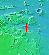
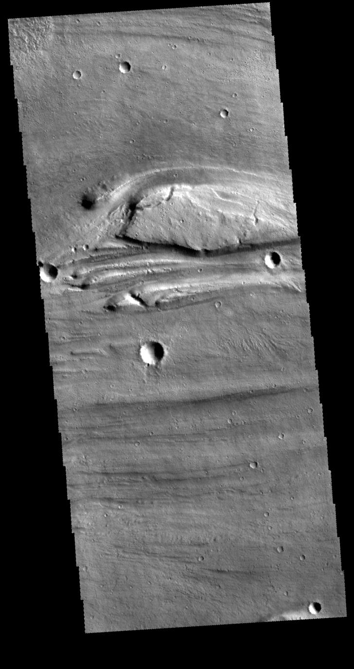
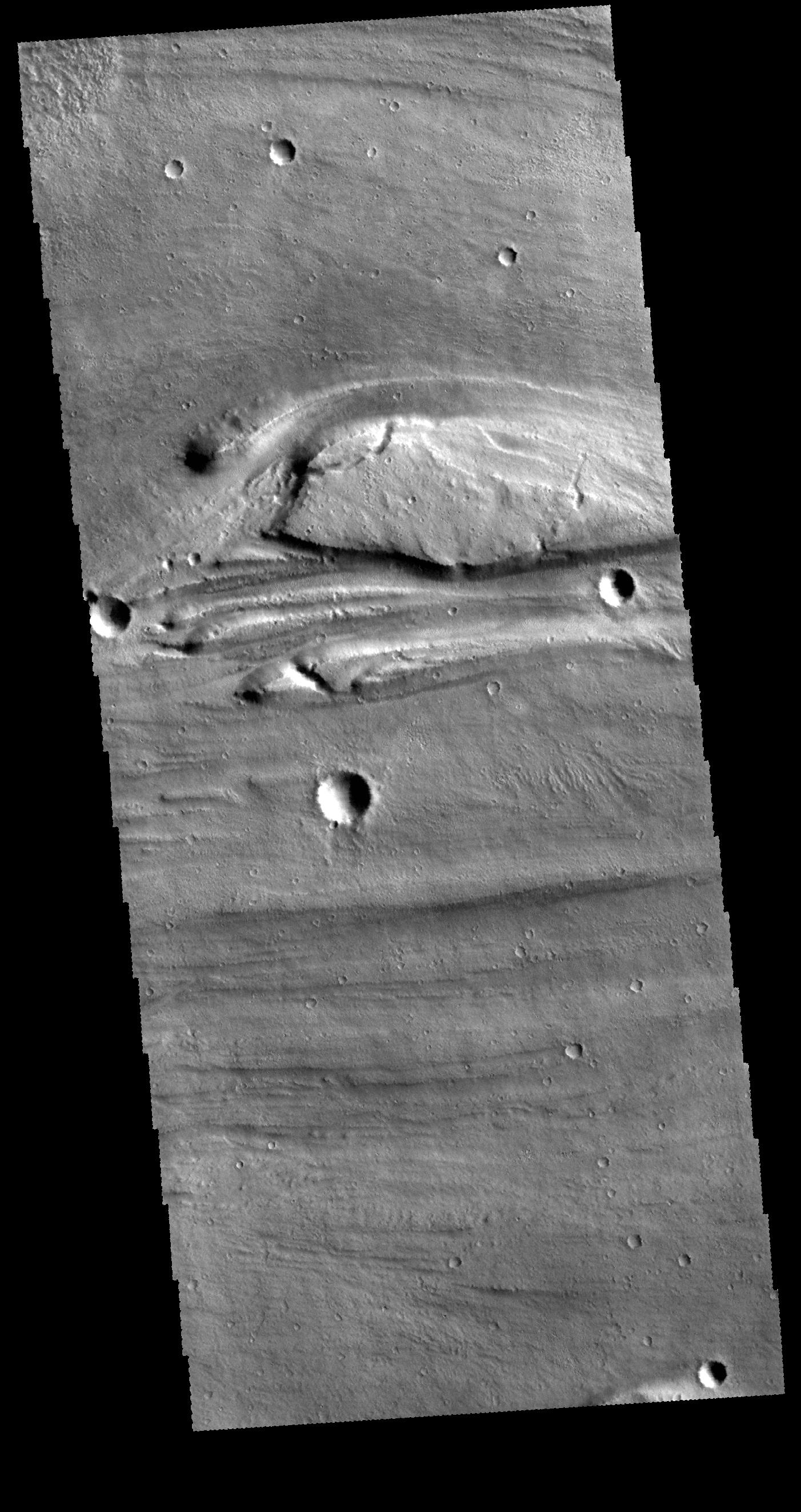
Context imageThis VIS image shows a very small portion of Kasei Valles. There are several streamlined islands near the center of the image. The wider part of the island is to the left and the narrowing of the 'tail' it to the right, indicating that the flow of the liquid that formed these islands ran from west to east. These features are located near the region where Kasei Valles empties into Chryse Planitia.
Orbit Number: 62101 Latitude: 25.0071 Longitude: 308.382 Instrument: VIS Captured: 2015-12-14 04:04
Please see the THEMIS Data Citation Note for details on crediting THEMIS images.
NASA's Jet Propulsion Laboratory manages the 2001 Mars Odyssey mission for NASA's Science Mission Directorate, Washington, D.C. The Thermal Emission Imaging System (THEMIS) was developed by Arizona State University, Tempe, in collaboration with Raytheon Santa Barbara Remote Sensing. The THEMIS investigation is led by Dr. Philip Christensen at Arizona State University. Lockheed Martin Astronautics, Denver, is the prime contractor for the Odyssey project, and developed and built the orbiter. Mission operations are conducted jointly from Lockheed Martin and from JPL, a division of the California Institute of Technology in Pasadena.