
Map Projected Browse Image
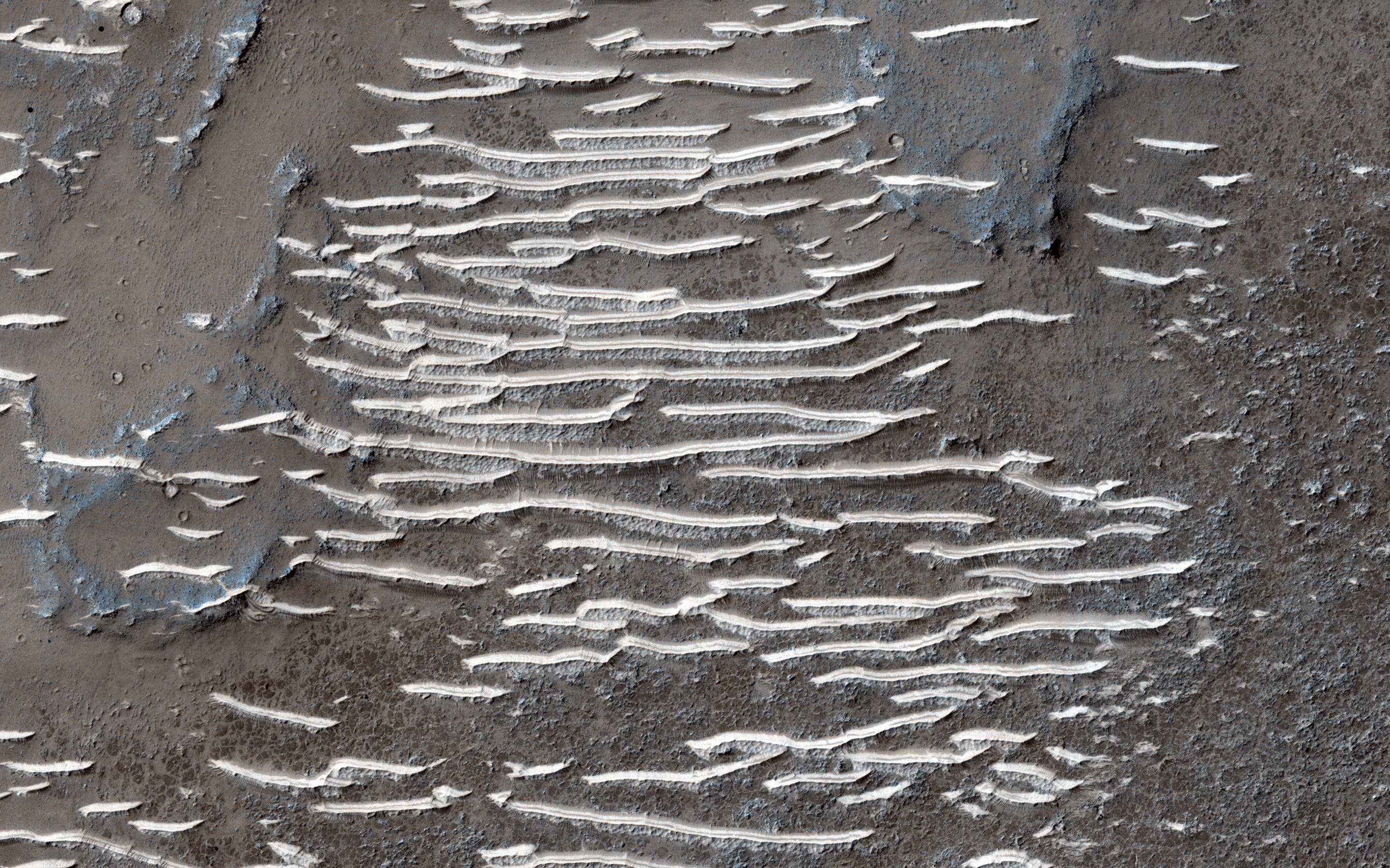
Click on the image for larger versionTransverse aeolian ridges -- or TAR -- are mysterious, wind-blown features that are intermediate in size between ripples and much larger sand dunes.
Ripples form from hopping sand grains, and dunes form from sand grains being blown over longer distances. One hypothesis for TAR formation is that larger grains like pebbles are rolled on top of smaller ripples; then, finer dust settles into the cracks, "inflating" the pebbles, making the TAR larger than typical ripples.
Looking between the TAR, one sees a network of ancient, beaten-up channels that were carved by water, lava, or both.
This whole area is located in Solis Planum, an interesting, tectonic terrain south of Noctis Labrynthus which generally slopes toward the south.
The University of Arizona, Tucson, operates HiRISE, which was built by Ball Aerospace & Technologies Corp., Boulder, Colo. NASA's Jet Propulsion Laboratory, a division of the California Institute of Technology in Pasadena, manages the Mars Reconnaissance Orbiter Project for NASA's Science Mission Directorate, Washington.

