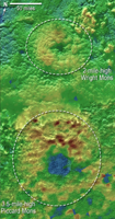
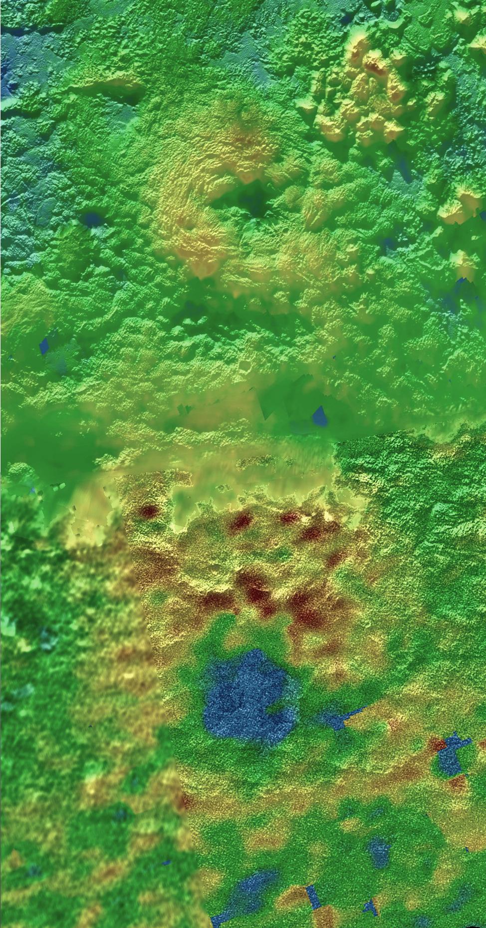
Annotated Version
Click on the image for larger versionScientists using New Horizons images of Pluto's surface to make 3-D topographic maps have discovered that two of Pluto's mountains, informally named Wright Mons and Piccard Mons, could possibly be ice volcanoes. The color is shown to depict changes in elevation, with blue indicating lower terrain and brown showing higher elevation; green terrains are at intermediate heights.
The Johns Hopkins University Applied Physics Laboratory in Laurel, Maryland, designed, built, and operates the New Horizons spacecraft, and manages the mission for NASA's Science Mission Directorate. The Southwest Research Institute, based in San Antonio, leads the science team, payload operations and encounter science planning. New Horizons is part of the New Frontiers Program managed by NASA's Marshall Space Flight Center in Huntsville, Alabama.

