
Map Projected Browse Image
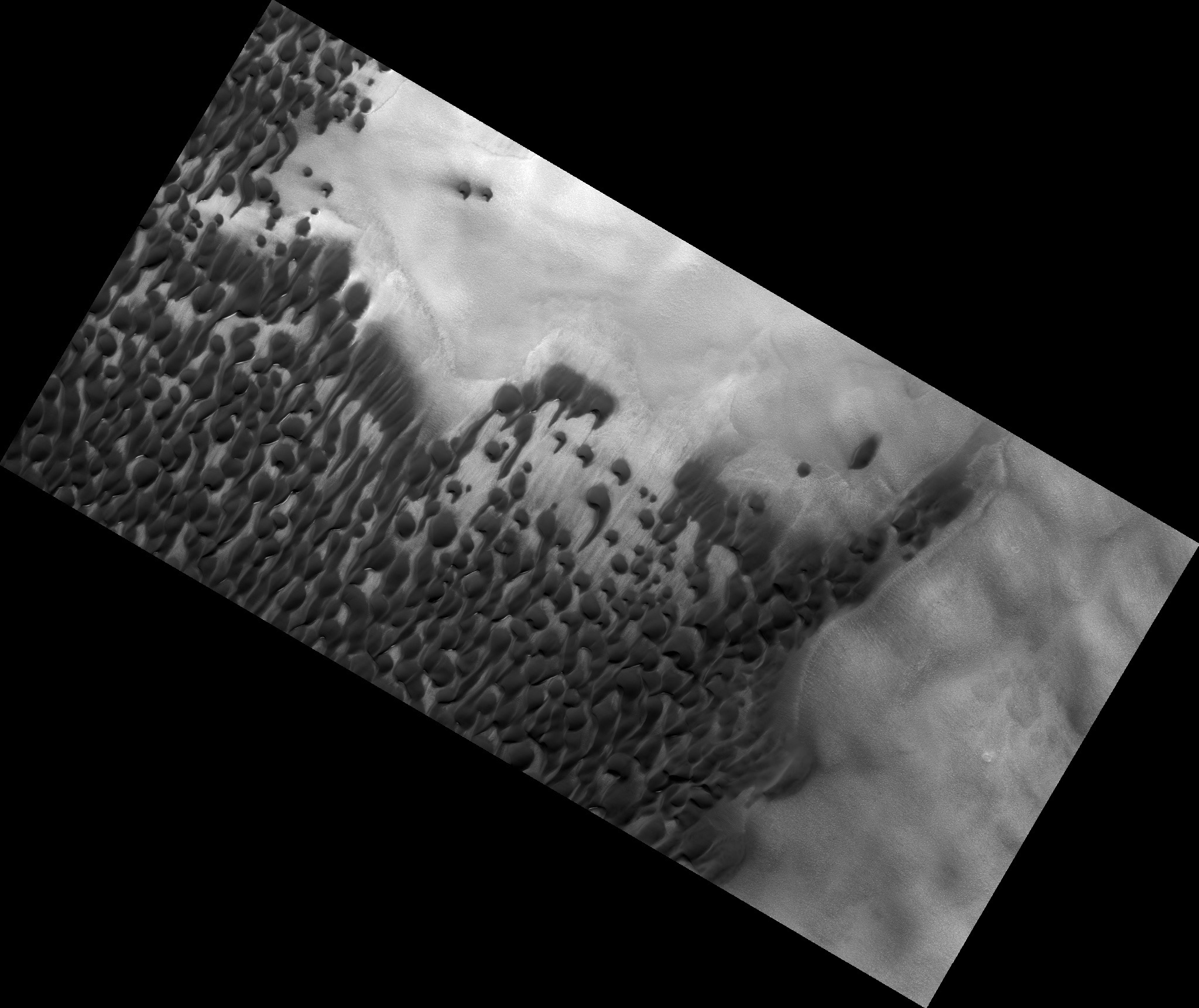
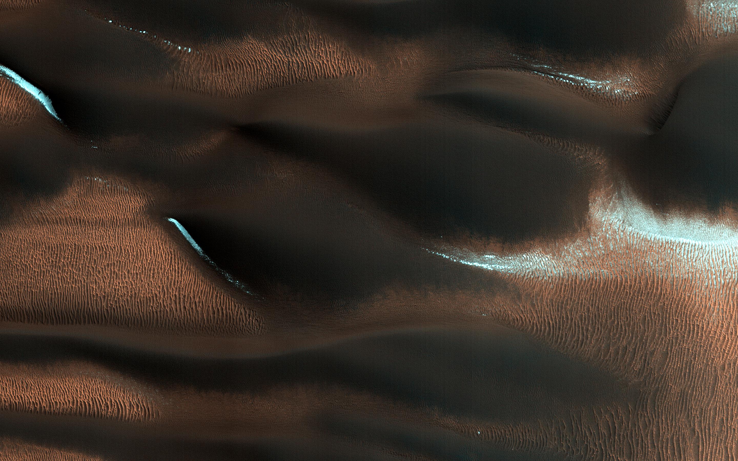
Click on the image for larger versionThis HiRISE image shows modified barchan dunes with shapes that resemble "raptor claws." The unusual morphology of these dunes suggests a limited supply of windblown sand.
Winds likely blew from the northeast resulting in elongate dunes with an asymmetric downwind point. The transverse crests of the smaller ripples/mega-ripple bed-forms surrounding the dune, echo the dominant downwind direction towards the southwest.
This locality is in the Northern Lowlands directly east of Dokka Crater in Scandia Cavi.
The University of Arizona, Tucson, operates HiRISE, which was built by Ball Aerospace & Technologies Corp., Boulder, Colo. NASA's Jet Propulsion Laboratory, a division of the California Institute of Technology in Pasadena, manages the Mars Reconnaissance Orbiter Project for NASA's Science Mission Directorate, Washington.
