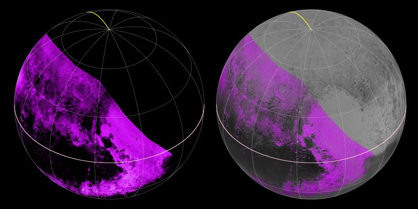
The Ralph/LEISA infrared spectrometer on NASA's New Horizons spacecraft mapped compositions across Pluto's surface as it flew past the planet on July 14, 2015. On the left, a map of methane ice abundance shows striking regional differences, with stronger methane absorption indicated by the brighter purple colors, and lower abundances shown in black. Data have only been received so far for the left half of Pluto's disk. At right, the methane map is merged with higher-resolution images from the spacecraft's Long Range Reconnaissance Imager (LORRI).
The Johns Hopkins University Applied Physics Laboratory in Laurel, Maryland, designed, built, and operates the New Horizons spacecraft, and manages the mission for NASA's Science Mission Directorate. The Southwest Research Institute, based in San Antonio, leads the science team, payload operations and encounter science planning. New Horizons is part of the New Frontiers Program managed by NASA's Marshall Space Flight Center in Huntsville, Alabama.