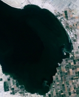
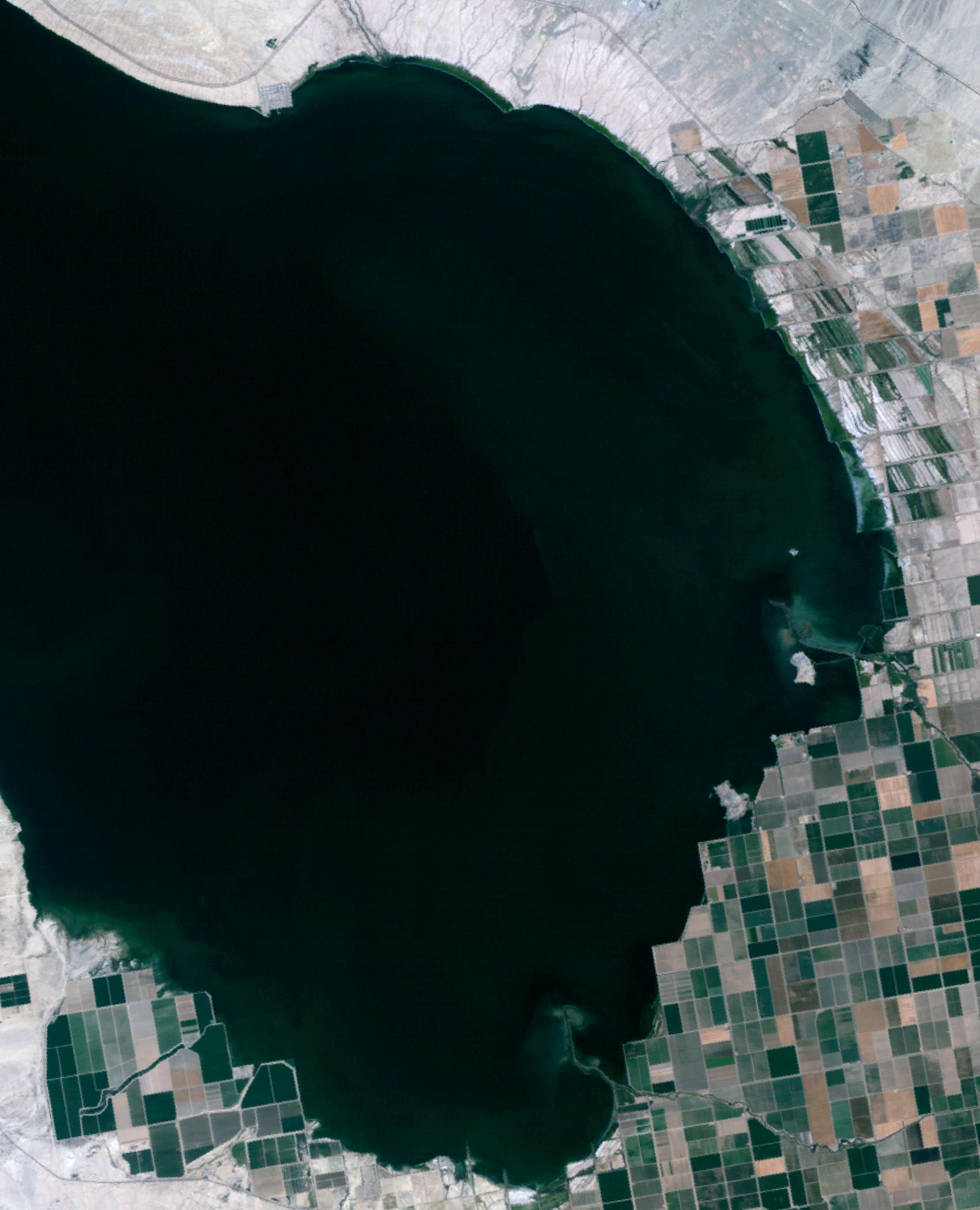
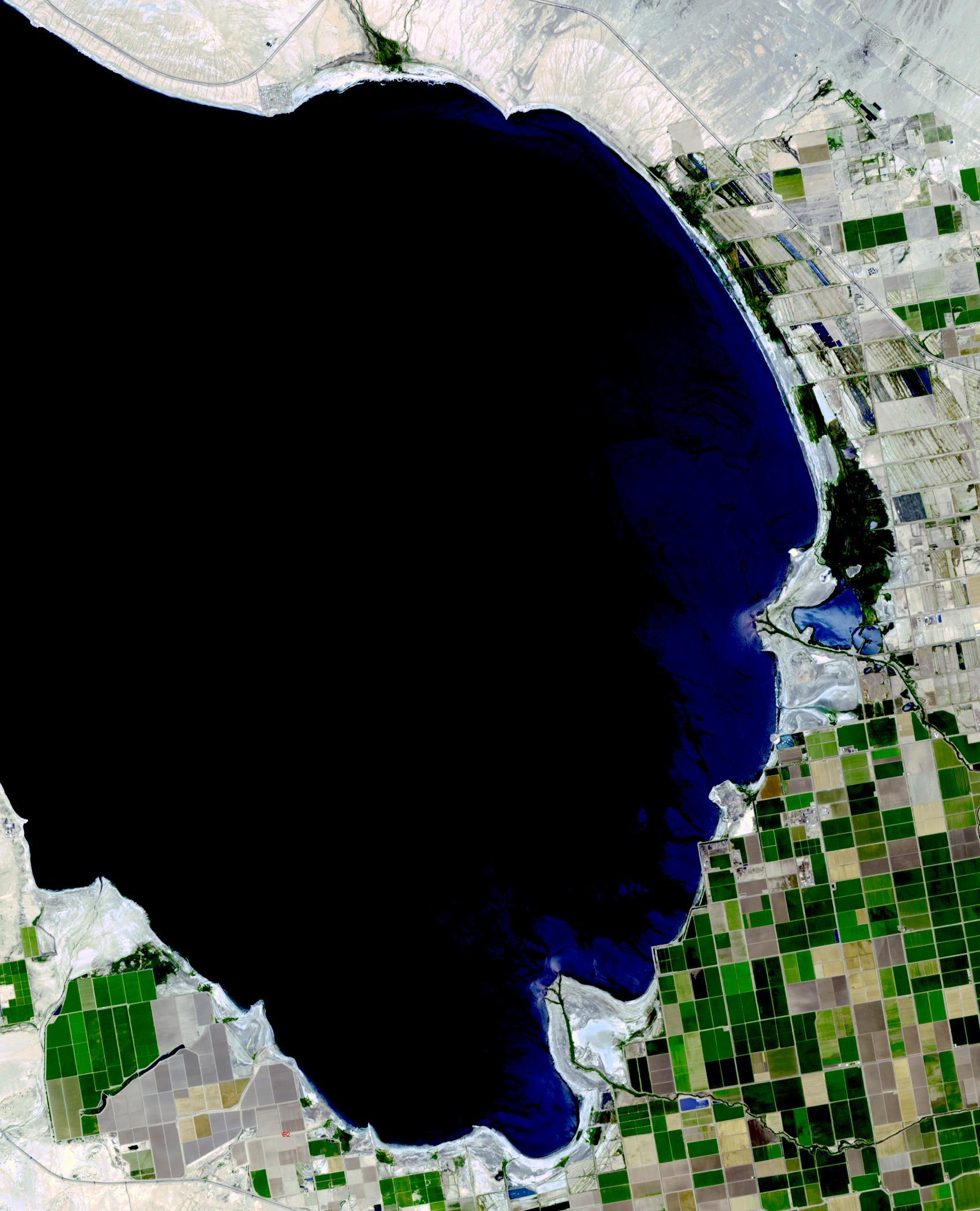
Salton Sea, California 1984The Salton Sea in south California was created in 1905 when spring flooding on the Colorado River breached a canal. For 18 months the entire volume of the river rushed into the Salton Trough, creating a lake 32 km wide and 72 km long. In the 1950s, resorts sprang up along the shores. However, shrinking of the lake and increased salinity led to the abandonment of the resorts. The two images show the shrinking lake on May 31, 1984 (Landsat) and June 14, 2015 (ASTER). The images cover an area of 37.5 x 27 km, and are located at 33.2 degrees north, 115.7 degrees west.
With its 14 spectral bands from the visible to the thermal infrared wavelength region and its high spatial resolution of 15 to 90 meters (about 50 to 300 feet), ASTER images Earth to map and monitor the changing surface of our planet. ASTER is one of five Earth-observing instruments launched Dec. 18, 1999, on Terra. The instrument was built by Japan's Ministry of Economy, Trade and Industry. A joint U.S./Japan science team is responsible for validation and calibration of the instrument and data products.
The broad spectral coverage and high spectral resolution of ASTER provides scientists in numerous disciplines with critical information for surface mapping and monitoring of dynamic conditions and temporal change. Example applications are: monitoring glacial advances and retreats; monitoring potentially active volcanoes; identifying crop stress; determining cloud morphology and physical properties; wetlands evaluation; thermal pollution monitoring; coral reef degradation; surface temperature mapping of soils and geology; and measuring surface heat balance.
The U.S. science team is located at NASA's Jet Propulsion Laboratory, Pasadena, Calif. The Terra mission is part of NASA's Science Mission Directorate, Washington, D.C.
More information about ASTER is available at http://asterweb.jpl.nasa.gov/.
