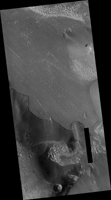
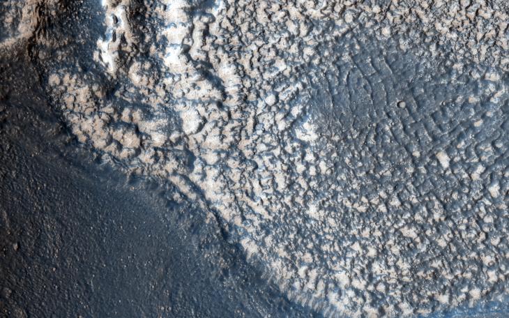
Map Projected Browse Image
Click on the image for larger versionThis highly tectonized terrain (meaning it possesses many faults) has its low-lying areas filled with some form of younger material. This particular fill is what geologists call "embayment."
This observation helps scientists unravel the relative timing of the emplacement of the younger material and the numerous tectonic faults that run through this area.
The University of Arizona, Tucson, operates HiRISE, which was built by Ball Aerospace & Technologies Corp., Boulder, Colorado. NASA's Jet Propulsion Laboratory, a division of the California Institute of Technology in Pasadena, manages the Mars Reconnaissance Orbiter Project and Mars Science Laboratory Project for NASA's Science Mission Directorate, Washington.
