
Map Projected Browse Image
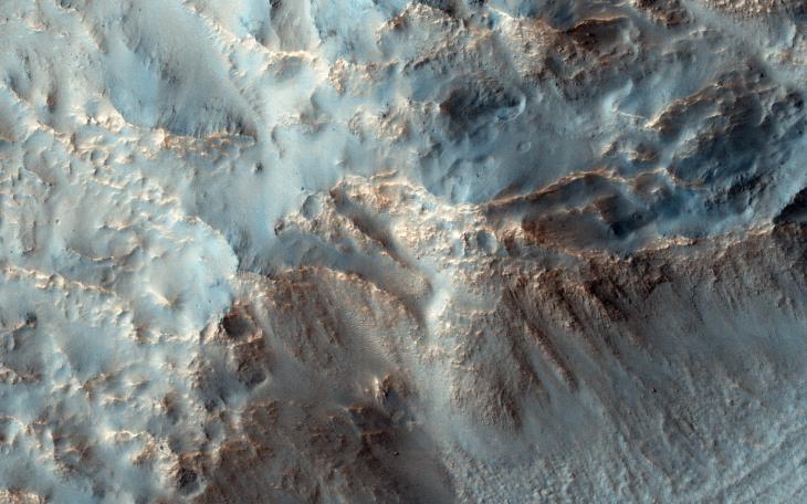
Click on the image for larger versionIn the search for potential areas with recurring slope lineae (RSL), which are probably caused by briny water, the central peak of Hale Crater is a common target. But we have no images of the southeast rim of the crater. Hale Crater is about 150 kilometers (90 miles) in diameter and located in the mid-southern latitudes just north of the massive Argyre basin.
RSL are often found on northwest-facing slopes, and they occur in the central peak of Hale. During the season when we know RSL appear, this observation at high resolution might help us see if they occur elsewhere.
This caption is based on the original science rationale.
The University of Arizona, Tucson, operates HiRISE, which was built by Ball Aerospace & Technologies Corp., Boulder, Colo. NASA's Jet Propulsion Laboratory, a division of the California Institute of Technology in Pasadena, manages the Mars Reconnaissance Orbiter Project for NASA's Science Mission Directorate, Washington.