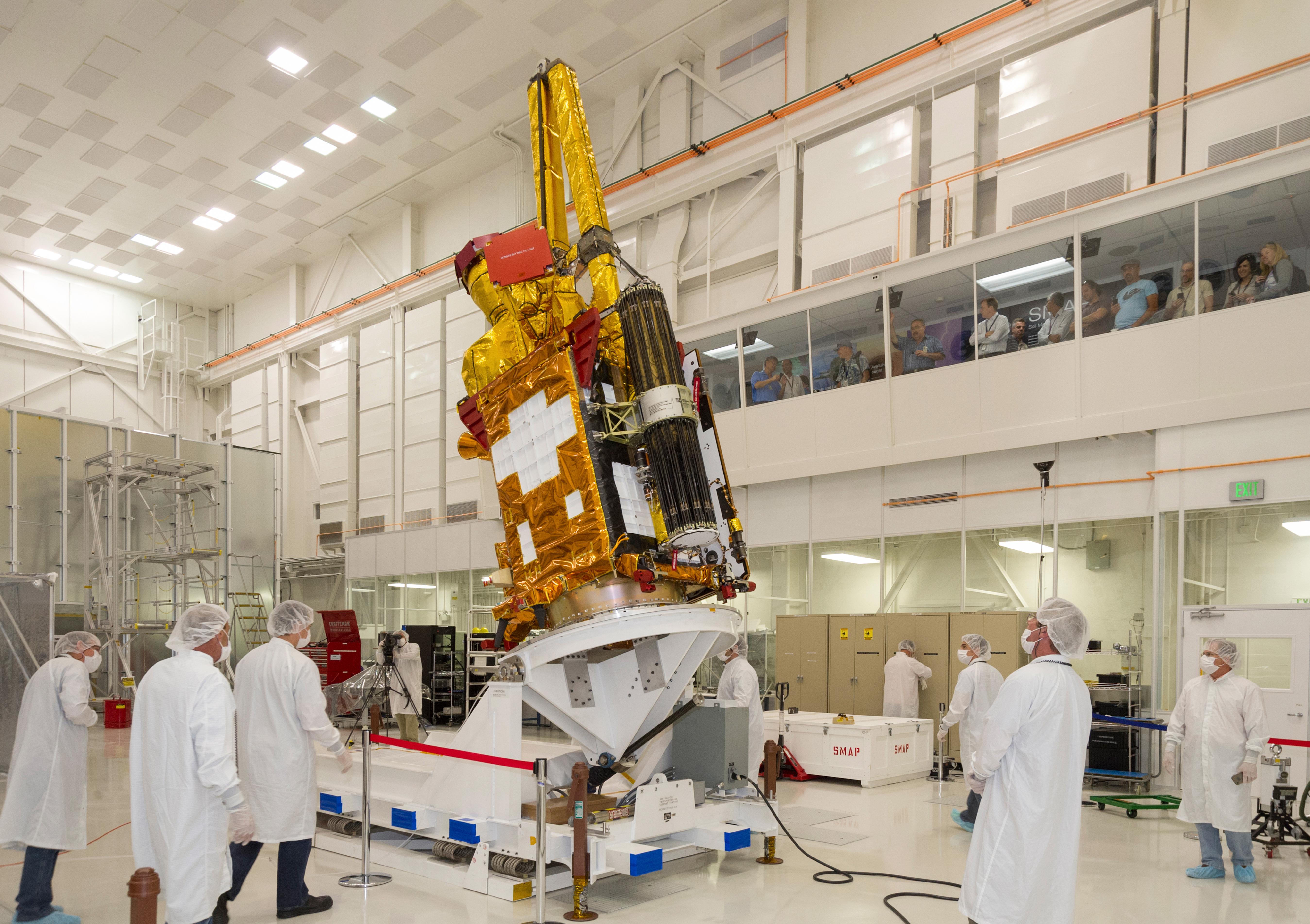
NASA's Soil Moisture Active Passive (SMAP) spacecraft is slowly lowered into place in the Spacecraft Assembly Facility at NASA's Jet Propulsion Laboratory, Pasadena, California, in preparation for shipping to California's Vandenberg Air Force Base on Oct. 15. SMAP will fly in a 426-mile (685-kilometer) altitude, near-polar, sun-synchronous orbit that crosses the equator near 6 a.m. and 6 p.m. local time. SMAP is designed to operate for at least three years, producing a global map of soil moisture every two to three days.
SMAP is managed for NASA's Science Mission Directorate in Washington by JPL with participation by NASA's Goddard Space Flight Center, Greenbelt, Maryland. JPL is responsible for project management, system engineering, instrument management, the radar instrument, mission operations and the ground data system. Goddard is responsible for the radiometer instrument. Both centers collaborate on the science data processing and delivery of science data products to the Alaska Satellite Facility and the National Snow and Ice Data Center for public distribution and archiving. NASA's Launch Services Program at NASA's Kennedy Space Center in Florida is responsible for launch management. JPL is managed for NASA by the California Institute of Technology in Pasadena.
For more information about SMAP, visit http://smap.jpl.nasa.gov.
