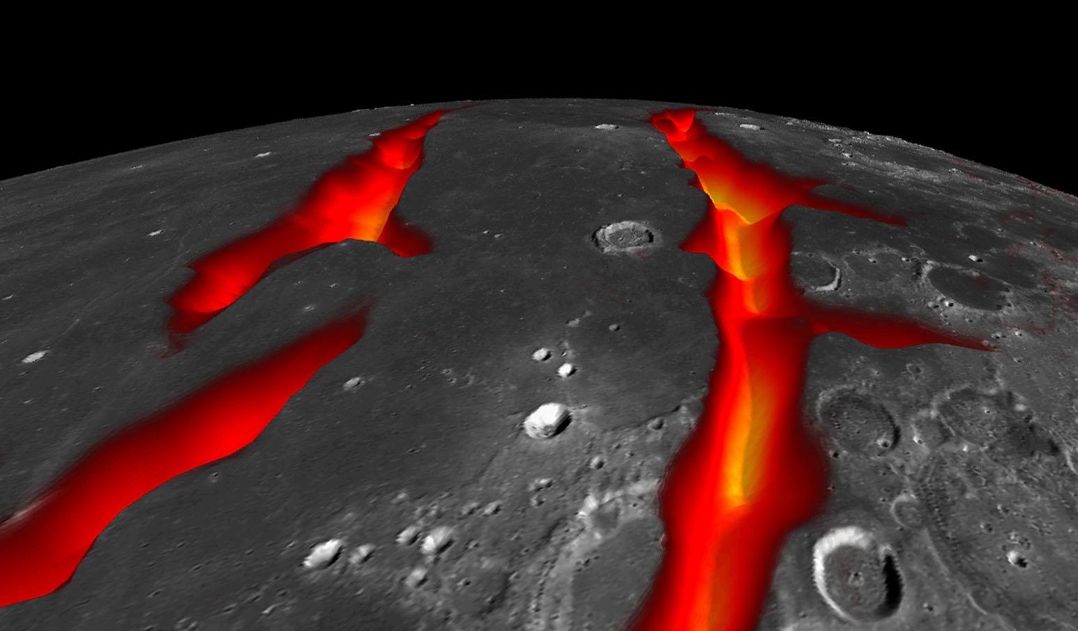
A view of Earth's moon looking south across Oceanus Procellarum, representing how the western border structures may have looked while active. The gravity anomalies along the border structures are interpreted as ancient, solidified, lava-flooded rifts that are now buried beneath the surface of the dark volcanic plains, or maria, on the near side of the moon.
This artist's concept combines gravity gradients from NASA's Gravity Recovery and Interior Laboratory (GRAIL) mission, an image mosaic from the Lunar Reconnaissance Orbiter's (LRO) Wide Angle Camera, and topography data from LRO's Lunar Orbiter Laser Altimeter.
Launched as GRAIL A and GRAIL B in September 2011, the probes, renamed Ebb and Flow, operated in a nearly circular orbit near the poles of the moon at an altitude of about 34 miles (55 kilometers) until their mission ended in December 2012. The distance between the twin probes changed slightly as they flew over areas of greater and lesser gravity caused by visible features, such as mountains and craters, and by masses hidden beneath the lunar surface.
The twin spacecraft flew in a nearly circular orbit until the end of the mission on Dec. 17, 2012, when the probes intentionally were sent into the moon's surface. NASA later named the impact site in honor of late astronaut Sally K. Ride, who was America's first woman in space and a member of the GRAIL mission team.
GRAIL's prime and extended science missions generated the highest-resolution gravity field map of any celestial body. The map will provide a better understanding of how Earth and other rocky planets in the solar system formed and evolved.
The GRAIL mission was managed by NASA's Jet Propulsion Laboratory (JPL) in Pasadena, California, for NASA's Science Mission Directorate in Washington. The mission was part of the Discovery Program managed at NASA's Marshall Space Flight Center in Huntsville, Alabama. GRAIL was built by Lockheed Martin Space Systems in Denver.
For more information about GRAIL, please visit http://grail.nasa.gov.
 Planetary Data System


