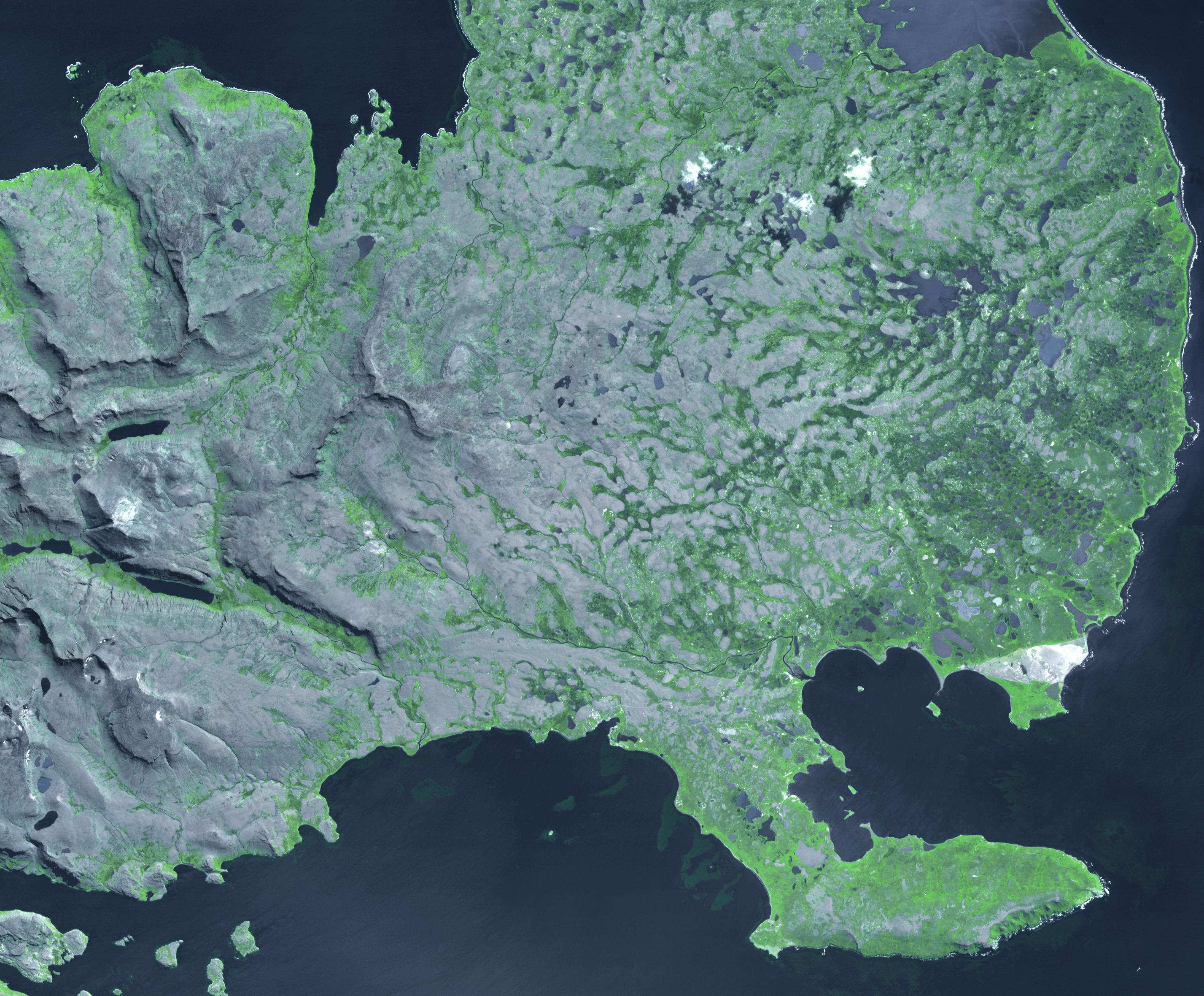
The Kerguelen Islands (also known as the Desolation Islands) are part of the French Southern and Antarctic lands. Located in the southern Indian Ocean, the islands are among the most isolated places on Earth, more than 3200 km away from the nearest populated location. The largest island is Grand Terre (120 by 150 km), with the capital city of Port-aux-Francais. Total population is around 100; all travel and transport is by ship. The French Space Agency operates a satellite and tracking station near the town. The image shows the eastern part of the island, and covers an area of 43 by 35 km, is located at 49.3 degrees south, 69.4 degrees east, and was acquired February 27, 2009.
With its 14 spectral bands from the visible to the thermal infrared wavelength region and its high spatial resolution of 15 to 90 meters (about 50 to 300 feet), ASTER images Earth to map and monitor the changing surface of our planet. ASTER is one of five Earth-observing instruments launched Dec. 18, 1999, on Terra. The instrument was built by Japan's Ministry of Economy, Trade and Industry. A joint U.S./Japan science team is responsible for validation and calibration of the instrument and data products.
The broad spectral coverage and high spectral resolution of ASTER provides scientists in numerous disciplines with critical information for surface mapping and monitoring of dynamic conditions and temporal change. Example applications are: monitoring glacial advances and retreats; monitoring potentially active volcanoes; identifying crop stress; determining cloud morphology and physical properties; wetlands evaluation; thermal pollution monitoring; coral reef degradation; surface temperature mapping of soils and geology; and measuring surface heat balance.
The U.S. science team is located at NASA's Jet Propulsion Laboratory, Pasadena, Calif. The Terra mission is part of NASA's Science Mission Directorate, Washington, D.C.
More information about ASTER is available at http://asterweb.jpl.nasa.gov/.
