
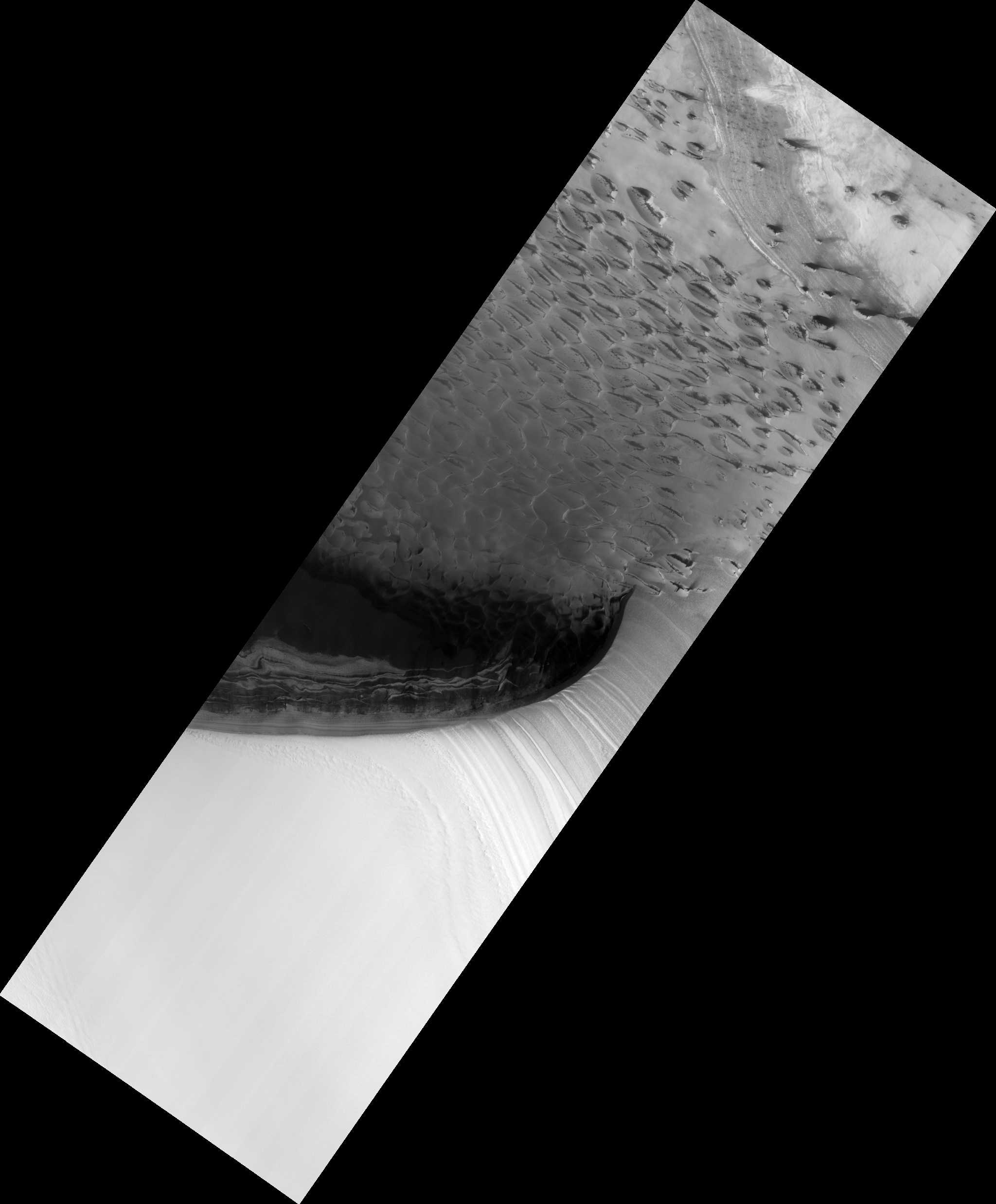
Map Projected Browse Image
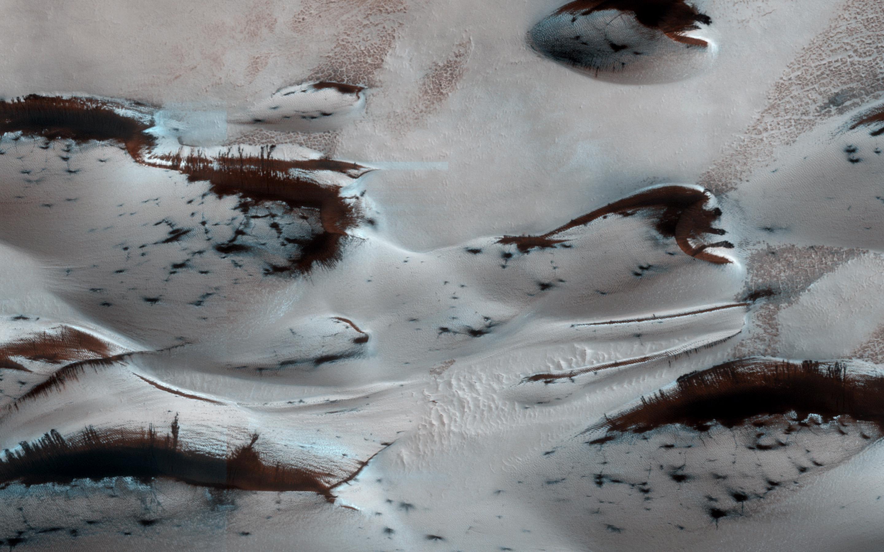
Click on the image for larger versionMars' northern-most sand dunes are beginning to emerge from their winter cover of seasonal carbon dioxide (dry) ice. Dark, bare south-facing slopes are soaking up the warmth of the sun.
The steep lee sides of the dunes are also ice-free along the crest, allowing sand to slide down the dune. Dark splotches are places where ice cracked earlier in spring, releasing sand. Soon the dunes will be completely bare and all signs of spring activity will be gone.
HiRISE is one of six instruments on NASA's Mars Reconnaissance Orbiter. The University of Arizona, Tucson, operates the orbiter's HiRISE camera, which was built by Ball Aerospace & Technologies Corp., Boulder, Colo. NASA's Jet Propulsion Laboratory, a division of the California Institute of Technology in Pasadena, manages the Mars Reconnaissance Orbiter Project for the NASA Science Mission Directorate, Washington.
