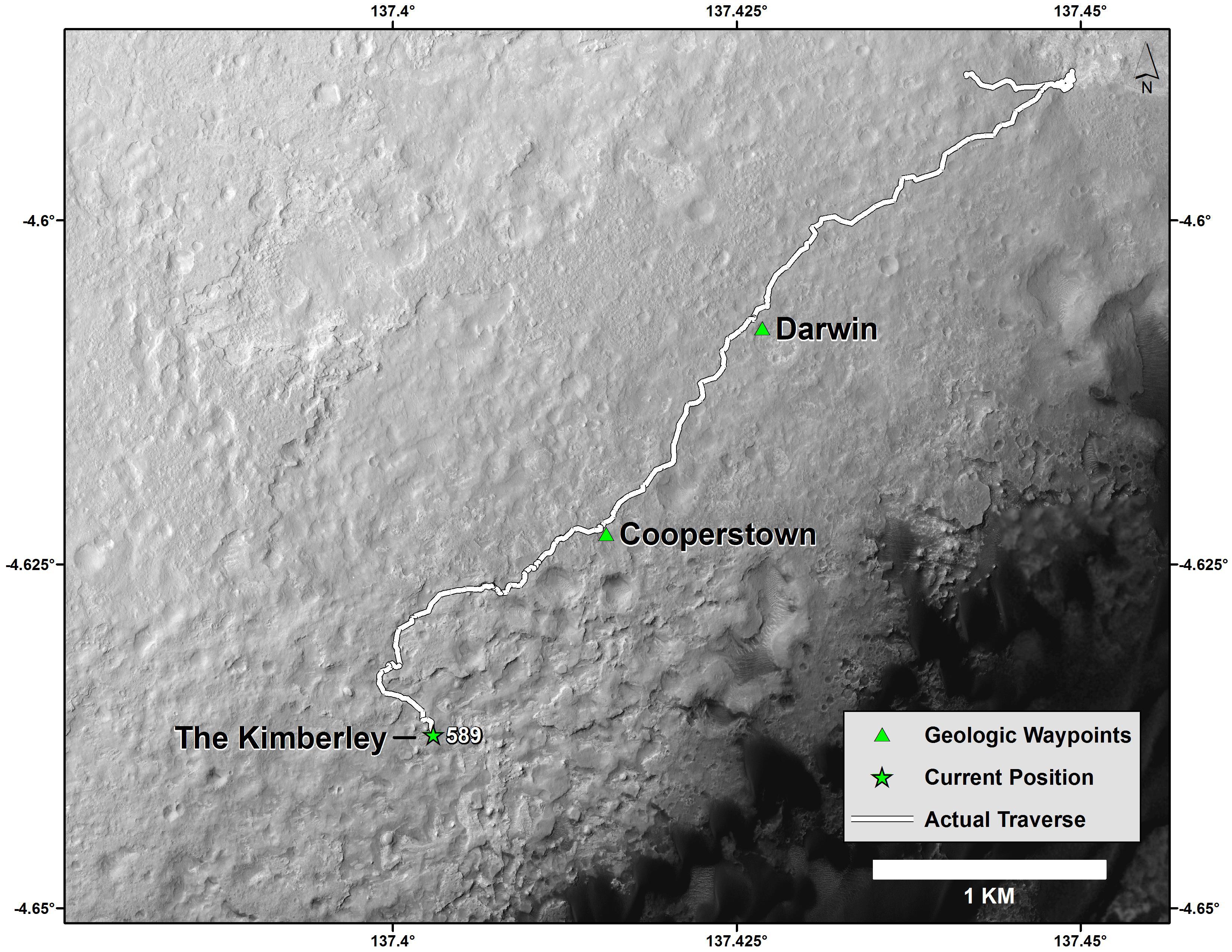
This map shows the route driven by NASA's Curiosity Mars rover from the "Bradbury Landing" location where it landed in August 2012 (the start of the line in upper right) to a major waypoint called "the Kimberley." The rover reached the Kimberley with a 98-foot (30 meter) drive on the 589th Martian day, or sol, of the rover's work on Mars (April 1, 2014).
The Kimberley (formerly called "KMS-9") was selected as a major waypoint for the mission because of the diversity of rock types distinguishable in orbital images, exposed close together at this location in a decipherable geological relationship to each other.
The base image for this map is from the High Resolution Imaging Science Experiment (HiRISE) camera on NASA's Mars Reconnaissance Orbiter. North is up. The dark ground south of the rover's route has dunes of dark, wind-blown material at the foot of Mount Sharp. The scale bar at lower right represents one kilometer (0.62 mile). For broader-context images of the area, see PIA17355, PIA16064 and PIA16058.
NASA's Jet Propulsion Laboratory, a division of the California Institute of Technology, Pasadena, manages the Mars Science Laboratory Project and Mars Reconnaissance Orbiter Project for NASA's Science Mission Directorate, Washington.
More information about Curiosity is online at http://www.nasa.gov/msl and http://mars.jpl.nasa.gov/msl/.
