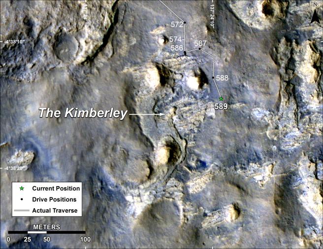
This map shows the route driven by NASA's Curiosity Mars rover during March and April 2014 in its approach to and arrival at a waypoint called "the Kimberley," which rover team scientists chose in 2013 as the location for the mission's next major investigations.
The numbers along the route designate the sol number of reaching that point. These are the number of Martian days, or sols, since Curiosity's August 2012 landing. The arrival drive, on Sol 589, was on April 2, 2014. The drive entering the area of this map, on Sol 572, was on March 16, 2014.
The Kimberley (formerly called "KMS-9") was selected as a major waypoint for the mission because of the diversity of rock types distinguishable in orbital images, exposed close together at this location in a decipherable geological relationship to each other.
The base image for this map is from the High Resolution Imaging Science Experiment (HiRISE) camera on NASA's Mars Reconnaissance Orbiter. North is up. The 100-meter scale bar at lower left represents 328 feet.
NASA's Jet Propulsion Laboratory, a division of the California Institute of Technology, Pasadena, manages the Mars Science Laboratory Project and Mars Reconnaissance Orbiter Project for NASA's Science Mission Directorate, Washington.
More information about Curiosity is online at http://www.nasa.gov/msl and http://mars.jpl.nasa.gov/msl/.