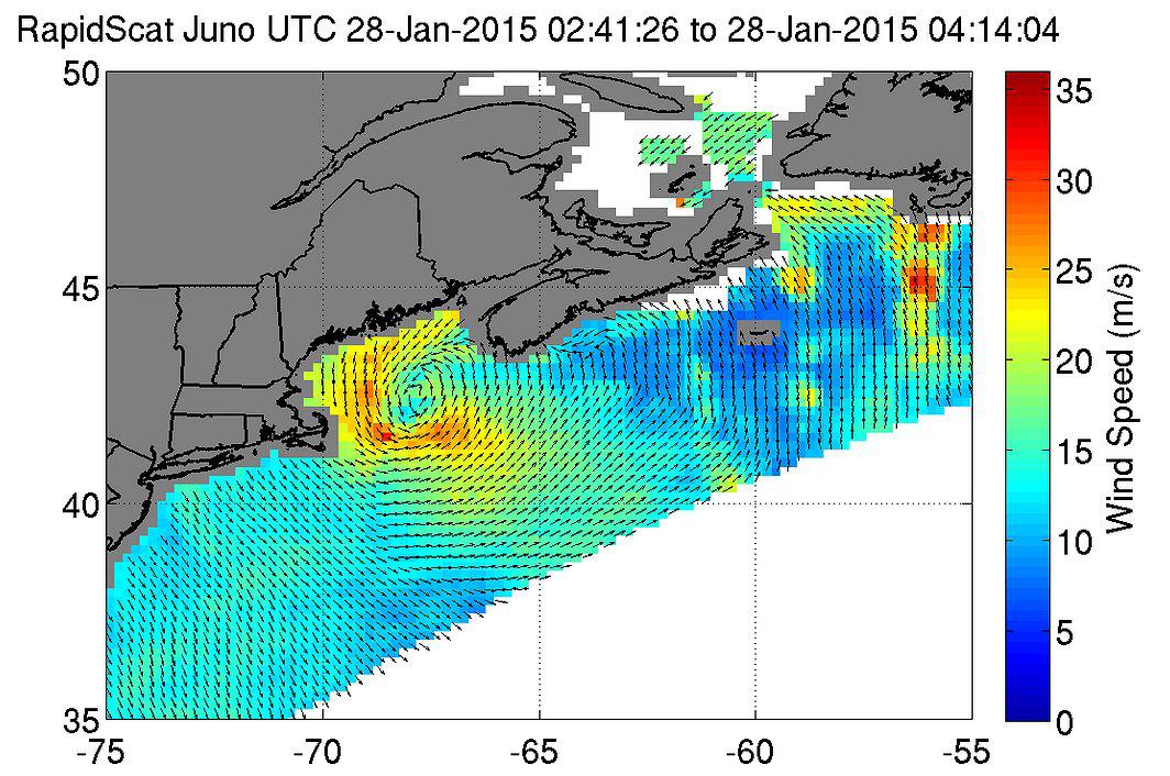
Earlier this year, RapidScat provided wind data on a nor'easter that affected New England and triggered blizzard warnings on Jan. 27 and 28. The wind data captured on the intense system showed the strongest winds on the first day near 78 miles per hour (35 meters per second/126 kilometers per hour) as it moved along the coast, stretching from eastern Long Island, New York, to southern Nova Scotia, Canada.
On Jan. 28, 2015 from 2:41 to 4:14 UTC, ISS-RapidScat saw the nor'easter's strongest sustained winds (red) between 56 and 67 mph (25 to 30 mps/90 to 108 kph) just off-shore from eastern Cape Cod.
The ISS-RapidScat instrument has been in orbit seven months, and forecasters are already finding this new eye-in-the-sky helpful as they keep watch on major storms around the globe.
RapidScat measures Earth's ocean surface wind speed and direction over open waters. The instrument's data on ocean winds provide essential measurements for researchers and scientists to use in weather predictions, including hurricane monitoring. The NASA instrument arrived at the International Space Station (ISS) on Sept. 23, 2014, providing a new resource for tracking and studying storms ranging from tropical cyclones to nor'easters. RapidScat has kept busy in 2015's already active Southern Hemisphere hurricane season and the Northern Hemisphere's winter storm season.
For more information on RapidScat, visit http://winds.jpl.nasa.gov/missions/RapidScat/ and http://www.nasa.gov/rapidscat.
