- Original Caption Released with Image:
-
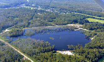
Aerial photo of a 25-acre sinkhole that formed
unexpectedly near Bayou Corne, La., in Aug. 2012
Image credit: On Wings of Care, New Orleans, La.
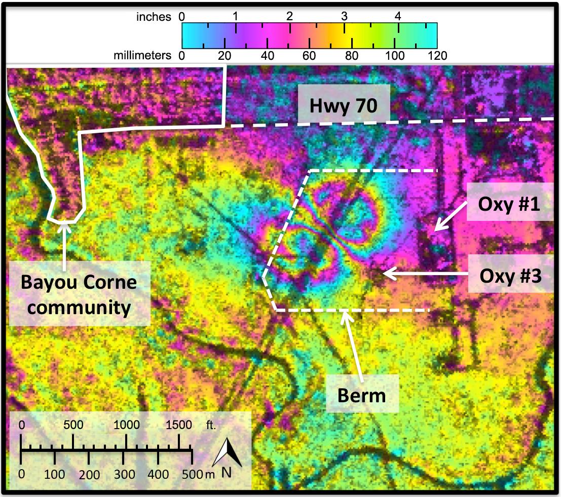
Click on the image for larger versionAnalyses by NASA's UAVSAR radar performed after the Bayou Corne, La., sinkhole formed show it was able to detect precursory ground surface movement of up to 10.2 inches (260 millimeters) more than a month before the sinkhole collapsed in Aug. 2012. This interferogram was formed with images acquired on June 23, 2011 and July 2, 2012. Colors represent surface movement, with one full color wrap corresponding to 4.7 inches (120 millimeters) of displacement.UAVSAR is part of NASA's ongoing effort to apply space-based technologies, ground-based techniques and complex computer models to advance our understanding of Earth deformation processes, such as those caused by earthquakes, volcanoes and landslides. UAVSAR is also serving as a flying test bed to evaluate the tools and technologies for future space- based radars, such as those planned for a NASA Synthetic Aperture Radar (SAR) mission currently in formulation. That mission will study hazards such as earthquakes, volcanoes and landslides, as well as global environmental change. For more information on UAVSAR, visit http://uavsar.jpl.nasa.gov/.
- Image Credit:
-
NASA/JPL-Caltech
Image Addition Date: -
2014-03-06
|

