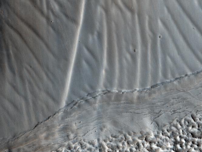
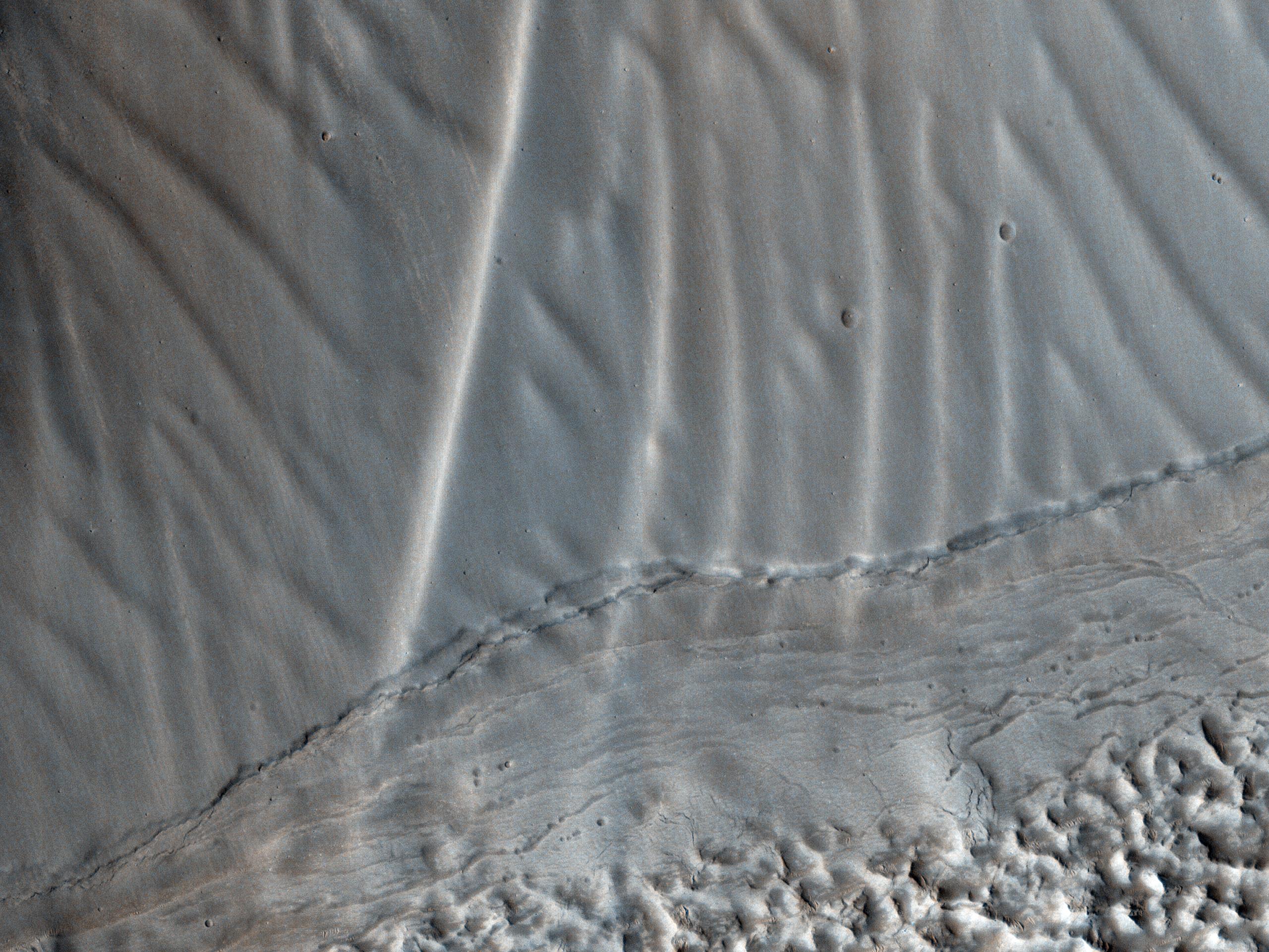
This observation shows us a set of landforms that appears to form a nested "chevron" pattern on a slope in Coloe Fossae. Interestingly, nearby surfaces on the same slope are all parallel.
How do these form? Are they bedforms created by the wind? Why do some slopes have these features and others do not?
Further down the image, we see fretted terrain that's mostly likely the result of glacial processes. The valley floor offers a stark contrast to the upper slopes and its delicate rippled landforms.
HiRISE is one of six instruments on NASA's Mars Reconnaissance Orbiter. The University of Arizona, Tucson, operates the orbiter's HiRISE camera, which was built by Ball Aerospace & Technologies Corp., Boulder, Colo. NASA's Jet Propulsion Laboratory, a division of the California Institute of Technology in Pasadena, manages the Mars Reconnaissance Orbiter Project for the NASA Science Mission Directorate, Washington.