
Sardinia Overview
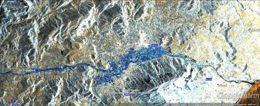
Click on the image for larger versionIn mid-November 2013, extratropical cyclone Cleopatra brought devastating flooding to the Italian island of Sardinia that has claimed at least 18 lives and led to the declaration of a state of emergency for the island. To assist in the disaster response efforts, scientists at NASA's Jet Propulsion Laboratory, Pasadena, Calif., in collaboration with the Italian Space Agency and Università degli studi della Basilicata, generated this preliminary version of a flood proxy map for inundated regions in Sardinia.
Areas of strong blue on the map are regions that have likely experienced flooding. The blue color represents a decrease of radar signal echo on Nov. 18, 2013 compared to data from Oct. 17, 2013. The decreased radar signal echo is likely to have been caused by water covering land (water has a smooth surface, which results in a weaker echo signal, while land has a rough surface and stronger echo). Flat regions that are colored dark blue can be interpreted as likely flooded regions, but other areas need further analysis before interpreting. Some distortion in the geolocation of this preliminary product is present in areas of high relief.
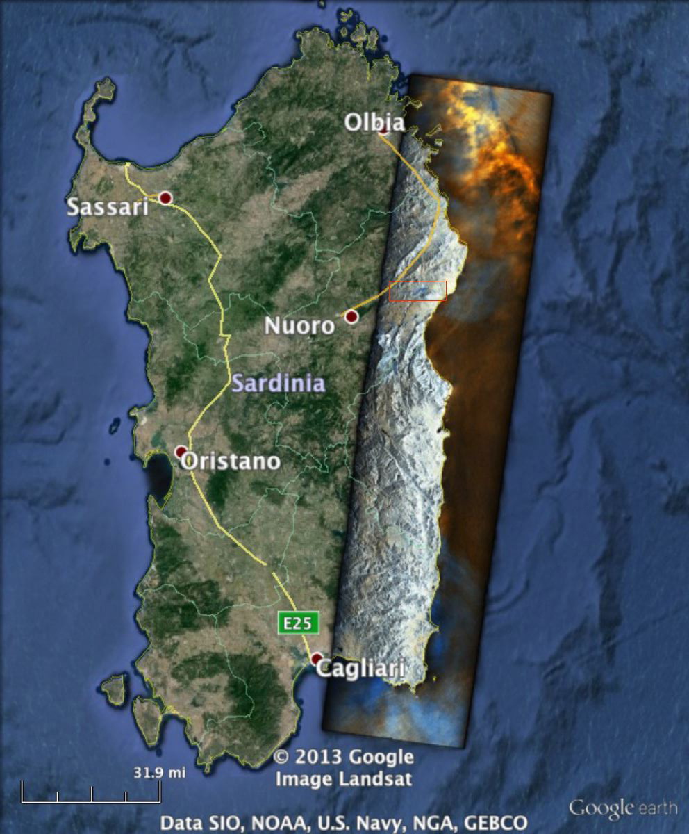
The approximately 5 by 12 miles (8 by 20 kilometers) map covers the region marked by the red rectangular box in the larger, 137 mile (220 kilometer) long overview image of Sardinia shown above processed by JPL's Advanced Rapid Imaging and Analysis (ARIA) team using X-band interferometric synthetic aperture radar data from the Italian Space Agency's COSMO-SkyMed satellite constellation. The technique uses a prototype algorithm to rapidly detect surface changes caused by natural or human-produced damage. It was processed as part of a joint collaboration between JPL, Caltech, the Italian Space Agency (ASI) Centro Interpretazione Dati di Osservazione della Terra (CIDOT) and the Università degli studi della Basilicata. Image processing was implemented using the JPL Interometric Synthetic Aperture Radar Scientific Computing Environment (ISCE) software package, and the amplitude images were registered to the NASA Shuttle Radar Topography Mission Plus digital elevation model with a resolution of 1 arc second. Individual pixel size of the flood map is about 98 feet (30 meters) across.
ARIA is a JPL- and NASA-funded project being developed by JPL and Caltech. It is building an automated system for providing rapid and reliable GPS and satellite data to support the local, national, and international hazard monitoring and response communities. Using space-based imagery of disasters, ARIA data products can provide rapid assessments of the geographic region impacted by a disaster, as well as detailed imaging of the locations where damage occurred.
For more information about ARIA, visit http://aria.jpl.nasa.gov.