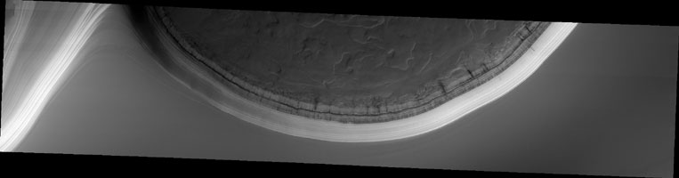
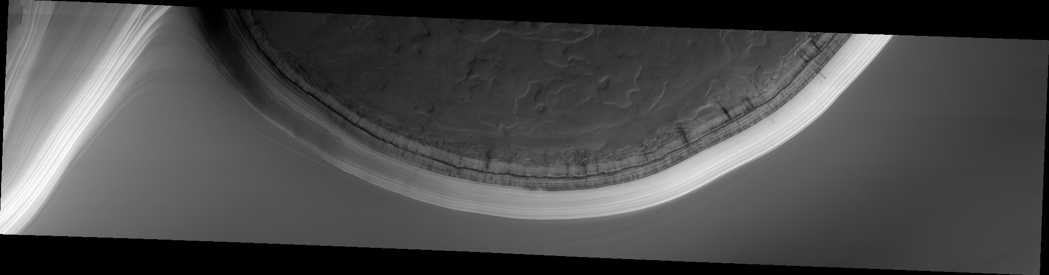
Map Projected Browse Image
Click on the image for larger versionThe North Polar region of Mars is capped with layers of water ice and dust, called the "polar layered deposits." This permanent polar cap is covered in the winter with a layer of seasonal carbon dioxide ice.
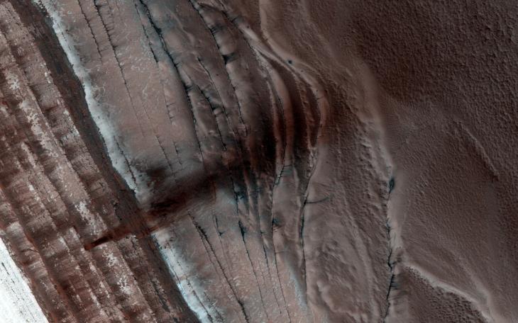
When the sun rises in the spring, the steep edges of the polar layered deposits are the first to warm up. The dry ice sublimes (going directly from a solid to a gas) and destabilizes loose chunks perched on the steep cliff. Material from the weaker layers gets dislodged and cascades down the steep slope.
Here, we can see a dark streak marking the path of that loose material, approximately 1 kilometer wide. HiRISE images often show avalanches in progress in the springtime along the edge of the polar layered deposits in this area.
HiRISE is one of six instruments on NASA's Mars Reconnaissance Orbiter. The University of Arizona, Tucson, operates the orbiter's HiRISE camera, which was built by Ball Aerospace & Technologies Corp., Boulder, Colo. NASA's Jet Propulsion Laboratory, a division of the California Institute of Technology in Pasadena, manages the Mars Reconnaissance Orbiter Project for the NASA Science Mission Directorate, Washington.