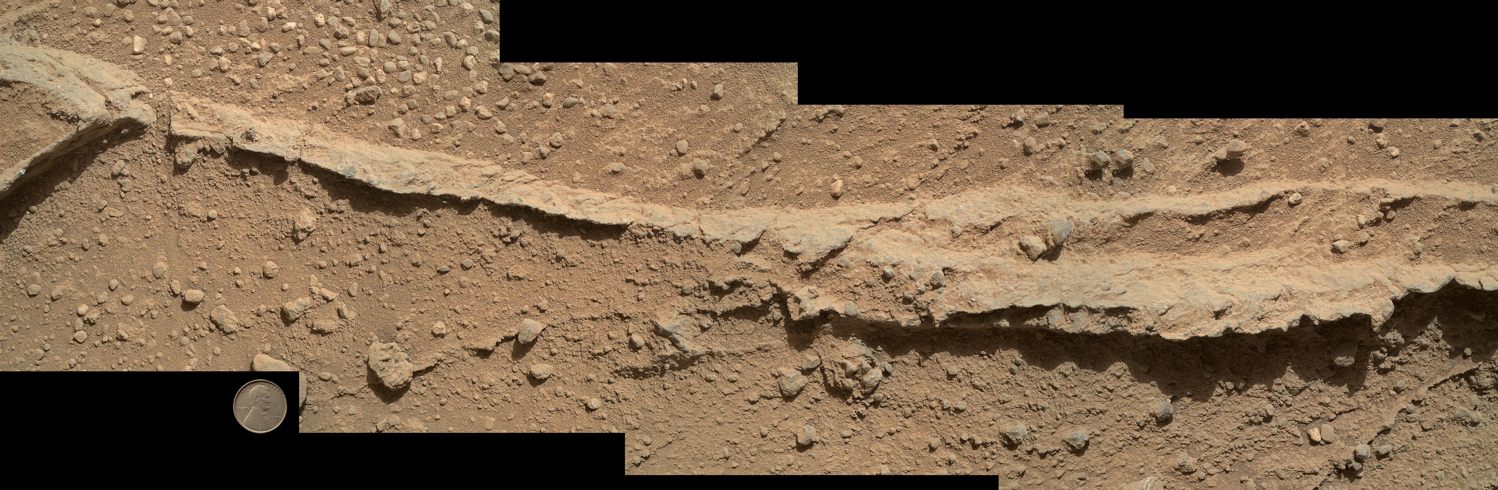
This mosaic of four images taken by the Mars Hand Lens Imager (MAHLI) camera on NASA's Mars rover Curiosity shows detailed texture in a ridge that stands higher than surrounding rock. The rock is at a location called "Darwin," inside Gale Crater. Exposed outcrop at this location, visible in images from the High Resolution Imaging Science Experment (HiRISE) camera on NASA's Mars Reconnaissance Orbiter, prompted Curiosity's science team to select it as the mission's first waypoint for several days during the mission's long trek from the "Glenelg" area to Mount Sharp.
MAHLI took the component images shortly before sunset on the 400th Martian day, or sol, of Curiosity's work on Mars (Sept. 21, 2013). The camera was positioned about 10 inches (25 centimeters) from the rock. Scale is indicated by the Lincoln penny from the MAHLI calibration target, shown beside the mosaic.
The ridge resulted from a crack or vein in the surrounding rock becoming filled with material that was subsequently more resistant to erosion than the material of the surrounding rock. Researchers are investigating the textures and composition of ridges and the surrounding rock, which is a pebbly sandstone conglomerate. Reddish dust coats the surfaces seen in this image. The underlying rocks are gray, varying from nearly white to nearly black. The host rock in which the crack or vein formed is obscured in this image by the coating of dust and a thin layer of the rock's own debris -- loose pebbles and sand.
Researchers also examined ridges at Waypoint 1 with Curiosity's Alpha Particle X-ray Spectrometer (APXS), Chemistry and Camera (ChemCam) instrument and Mast Camera (Mastcam).
Malin Space Science Systems, San Diego, developed, built and operates MAHLI. NASA's Jet Propulsion Laboratory, Pasadena, Calif., manages the Mars Science Laboratory Project and the mission's Curiosity rover for NASA's Science Mission Directorate in Washington. The rover was designed and assembled at JPL, a division of the California Institute of Technology in Pasadena.
More information about Curiosity is online at http://www.nasa.gov/msl and http://mars.jpl.nasa.gov/msl/.
 Planetary Data System


