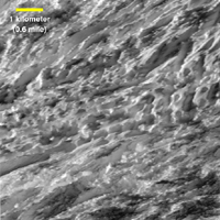
Labeled Version
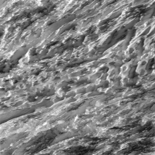
Click on the image for larger versionDuring its closest ever dive past the active south polar region of Saturn's moon Enceladus, NASA's Cassini spacecraft quickly shuttered its imaging cameras to capture glimpses of the fast moving terrain below. This view has been processed to remove slight smearing present in the original, unprocessed image that was caused by the spacecraft's fast motion.
A labeled version of this image includes a scale bar.
This view is centered on terrain at 57 degrees south latitude, 324 degrees west longitude. The image was taken in visible light with the Cassini spacecraft wide-angle camera on Oct. 28, 2015.
The view was acquired at a distance of approximately 77 miles (124 kilometers) from Enceladus. Image scale is 49 feet (15 meters) per pixel.
The Cassini mission is a cooperative project of NASA, ESA (the European Space Agency) and the Italian Space Agency. The Jet Propulsion Laboratory, a division of the California Institute of Technology in Pasadena, manages the mission for NASA's Science Mission Directorate, Washington. The Cassini orbiter and its two onboard cameras were designed, developed and assembled at JPL. The imaging operations center is based at the Space Science Institute in Boulder, Colorado.
For more information about the Cassini-Huygens mission visit http://saturn.jpl.nasa.gov and http://www.nasa.gov/cassini. The Cassini imaging team homepage is at http://ciclops.org.
Photojournal Note: This image was updated on Nov. 4, 2015, to correct the scale bar provided with the labeled version.

