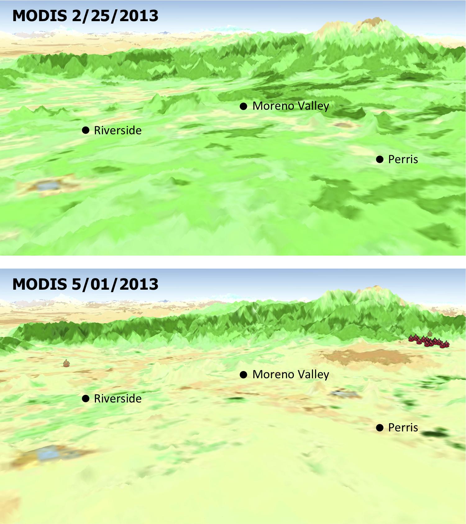
The quick dry-out of vegetation in Southern California this year is depicted in this pair of images from the Moderate Resolution Imaging Spectroradiometer (MODIS) sensor on NASA's Aqua spacecraft. MODIS measurements show more vegetation with greener areas on Feb. 25, 2013 (upper panel), compared to those on May 1, 2013 (lower panel), which is the nominal start date for fire season in Southern California. Locations where multiple wildfires erupted in late April and May 1 are marked.
New insights into two factors that are creating a potentially volatile Southern California wildfire season come from an ongoing project using NASA and Indian satellite data by scientists at NASA's Jet Propulsion Laboratory, Pasadena, Calif.; and Chapman University, Orange, Calif.
The scientists tracked the relationship between rainfall and the growth and drying-out of vegetation in recent months, during an abnormally dry year. They found the timing of rains triggered regional vegetation growth in January and early February, which then dried out faster than normal during a period of low rainfall, strong winds and high temperatures in March and April. The combination likely elevates wildfire risks by increasing available fuel.
The two institutions are combining satellite datasets to monitor moisture changes in vegetation and soil across Southern California's vast wilderness areas in order to identify early warning signs of potential wildfires. The scientists are using measurements of soil moisture change from the Indian Oceansat-2 satellite scatterometer (OSCAT) and of vegetation stress from the Moderate Resolution Imaging Spectroradiometer (MODIS) sensor on NASA's Aqua satellite.
The MODIS instrument is managed by NASA's Goddard Space Flight Center, Greenbelt, Md. For further information, access the MODIS home page at http://modis.gsfc.nasa.gov.
The California Institute of Technology in Pasadena manages JPL for NASA.
