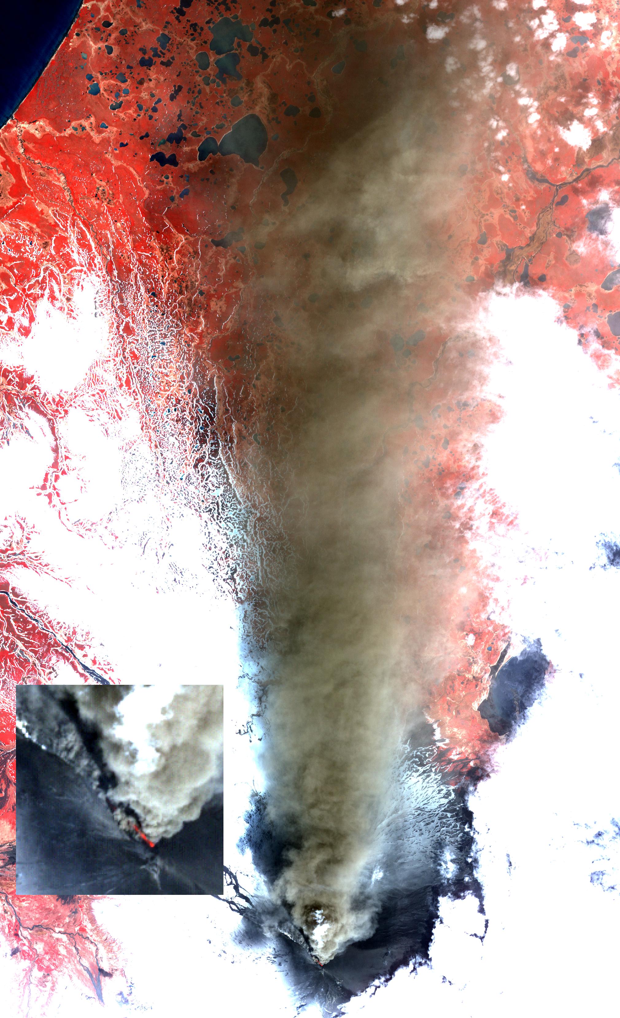
Alaska's Pavlof volcano, located along Alaska's Aleutian Peninsula, sent a low-level ash plume north-northeast about 37.3 miles (60 kilometers) on May 19, 2013, when this image was acquired by the Advanced Spaceborne Thermal Emission and Reflection Radiometer (ASTER) instrument on NASA's Terra spacecraft. A blow-up of the summit region clearly shows a red-hot incandescent pyroclastic flow descending to the north-northwest down the flank of the volcano. Pavlof has been one of the most active volcanoes in the United States in the last 30 years, with eight eruption episodes. The satellite image displays vegetation in red, clouds and snow in white, and the ash plume in brown. The current activity began on May 13. The image covers an area of 18.6 by 28.6 miles (30 by 46 kilometers), and is located at 55.4 degrees north latitude, 161.9 degrees west longitude.
With its 14 spectral bands from the visible to the thermal infrared wavelength region and its high spatial resolution of 15 to 90 meters (about 50 to 300 feet), ASTER images Earth to map and monitor the changing surface of our planet. ASTER is one of five Earth-observing instruments launched Dec. 18, 1999, on Terra. The instrument was built by Japan's Ministry of Economy, Trade and Industry. A joint U.S./Japan science team is responsible for validation and calibration of the instrument and data products.
The broad spectral coverage and high spectral resolution of ASTER provides scientists in numerous disciplines with critical information for surface mapping and monitoring of dynamic conditions and temporal change. Example applications are: monitoring glacial advances and retreats; monitoring potentially active volcanoes; identifying crop stress; determining cloud morphology and physical properties; wetlands evaluation; thermal pollution monitoring; coral reef degradation; surface temperature mapping of soils and geology; and measuring surface heat balance.
The U.S. science team is located at NASA's Jet Propulsion Laboratory, Pasadena, Calif. The Terra mission is part of NASA's Science Mission Directorate, Washington, D.C.
More information about ASTER is available at http://asterweb.jpl.nasa.gov/.
