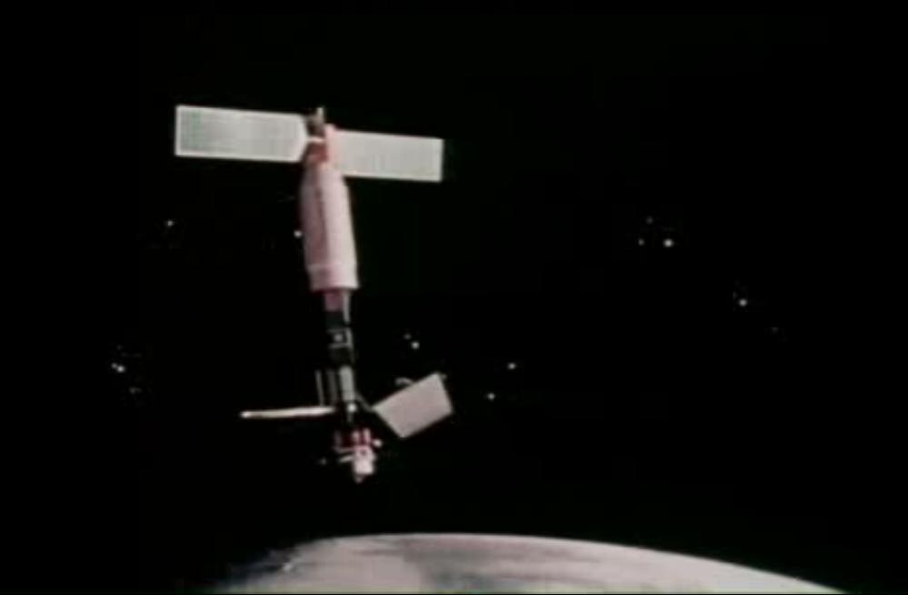
Click on the image for the animation
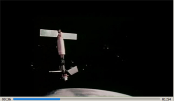
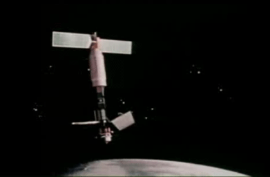
Seasat, built and managed by NASA's Jet Propulsion Laboratory (JPL), was launched thirty-five years ago, on June 27, 1978. It was the first satellite designed for remote sensing of the Earth's oceans using many ground-breaking technologies, such as:
- Altimeters
- Synthetic Aperture Radar – Earth Applications
- Synthetic Aperture Radar – Planetary Applications
- Scatterometers
- Radiometers
SeaSat is the legacy satellite that is the direct ancestor to many subsequent, current and future satellites.
The mission was designed to demonstrate the feasibility of global satellite monitoring of oceanographic phenomena and to help determine the requirements for an operational ocean remote sensing satellite system. Specific objectives were to collect data on sea-surface winds, sea-surface temperatures, wave heights, internal waves, atmospheric water, sea ice features and ocean topography. The mission ended on October 10, 1978 due to a failure of the vehicle's electric power system. Although only approximately 42 hours of real time data was received, the mission demonstrated the feasiblity of using microwave sensors to monitor ocean conditions.
JPL operated Seasat in Earth orbit for 105 days before a massive short circuit in the spacecraft's electrical system ended the mission on October 10, 1978.
Scientific instruments onboard SeaSat included the Radar altimeter, Synthetic Aperture Radar (SAR), SEASAT-A Satellite Scatterometer (SASS), Visible and Infrared Radiometer (VIRR), Scanning Multichannel Microwave Radiometer (SMMR).
Recently, the mission supplied the 35-year-old data to the Alaska Satellite Facility, a NASA Distributed Active Archive Center (DAAC), which has processed the data into a treasure trove of digital images. New imagery enables scientists to travel back in time for research on oceans, sea ice, volcanoes, forest land cover, glaciers and more. Before now, only a small percentage of Seasat data was processed digitally.
For more information about Seasat imagery, see http://www.asf.alaska.edu/seasat/about/.