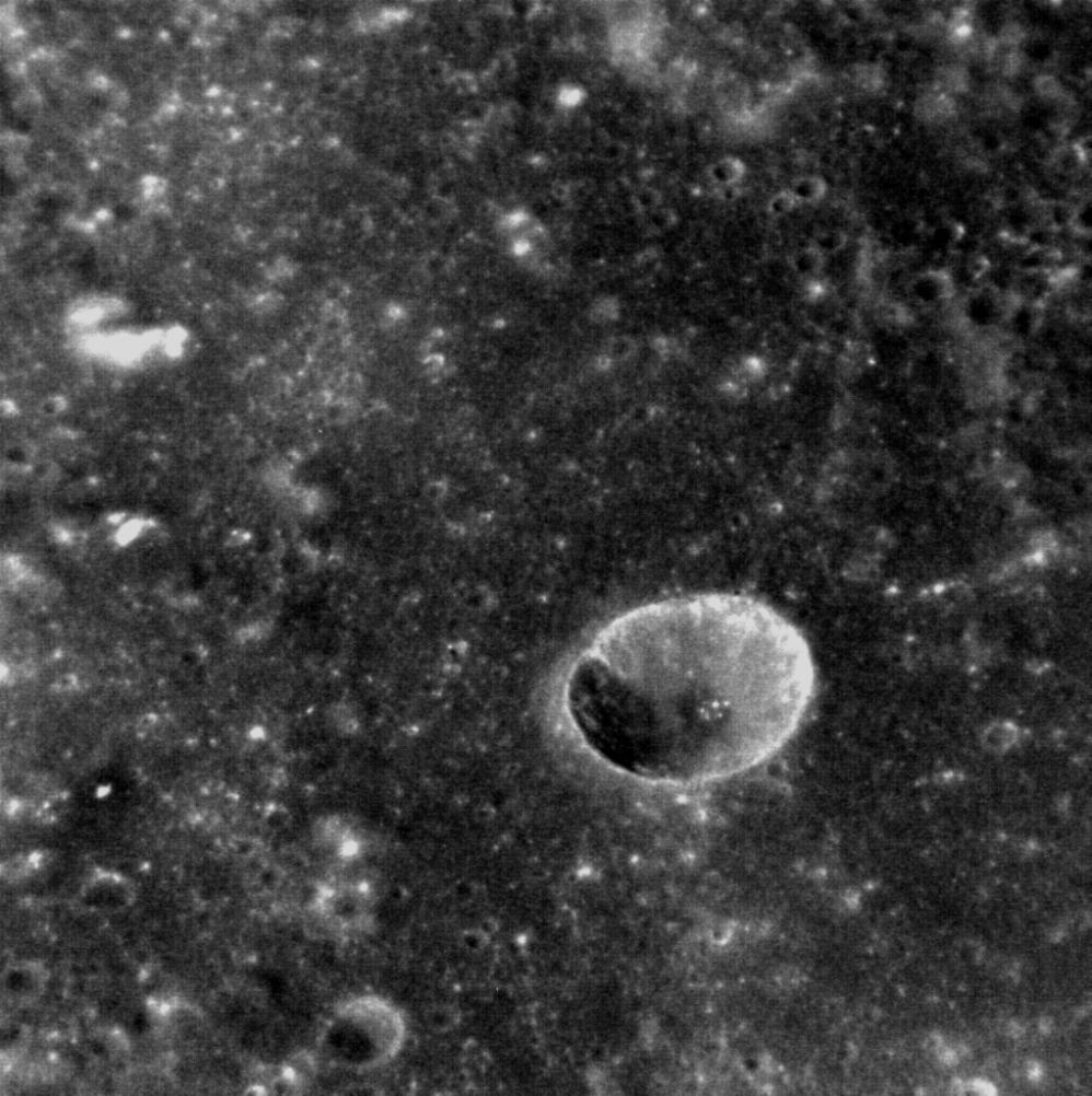
Although Mercury is replete with impact craters, it can be difficult to gauge their size in a meaningful way. This oblique image shows an unnamed crater that lies within the Rachmaninoff basin. It is a simple crater, characterized by its bowl-like shape, and lacks the central peak or peak ring of larger, complex craters. The famous Meteor Crater in Arizona, though also a simple crater, is five times smaller in diameter! (North is towards the upper left corner of the image.)
This image was acquired as a high-resolution targeted observation. Targeted observations are images of a small area on Mercury's surface at resolutions much higher than the 250-meter/pixel (820 feet/pixel) morphology base map or the 1-kilometer/pixel (0.6 miles/pixel) color base map. It is not possible to cover all of Mercury's surface at this high resolution during MESSENGER's one-year mission, but several areas of high scientific interest are generally imaged in this mode each week.
Date acquired: February 09, 2012
Image Mission Elapsed Time (MET): 237254445
Image ID: 1371698
Instrument: Narrow Angle Camera (NAC) of the Mercury Dual Imaging System (MDIS)
Center Latitude: 27.52°
Center Longitude: 54.40° E
Resolution: 30 meters/pixel
Scale: The crater in the center of the image is 7 km (4.4 miles) in diameter
Incidence Angle: 41.3°
Emission Angle: 40.1°
Phase Angle: 28.1°
The MESSENGER spacecraft is the first ever to orbit the planet Mercury, and the spacecraft's seven scientific instruments and radio science investigation are unraveling the history and evolution of the Solar System's innermost planet. Visit the Why Mercury? section of this website to learn more about the key science questions that the MESSENGER mission is addressing. During the one-year primary mission, MDIS is scheduled to acquire more than 75,000 images in support of MESSENGER's science goals.
These images are from MESSENGER, a NASA Discovery mission to conduct the first orbital study of the innermost planet, Mercury. For information regarding the use of images, see the MESSENGER image use policy.
 Planetary Data System


