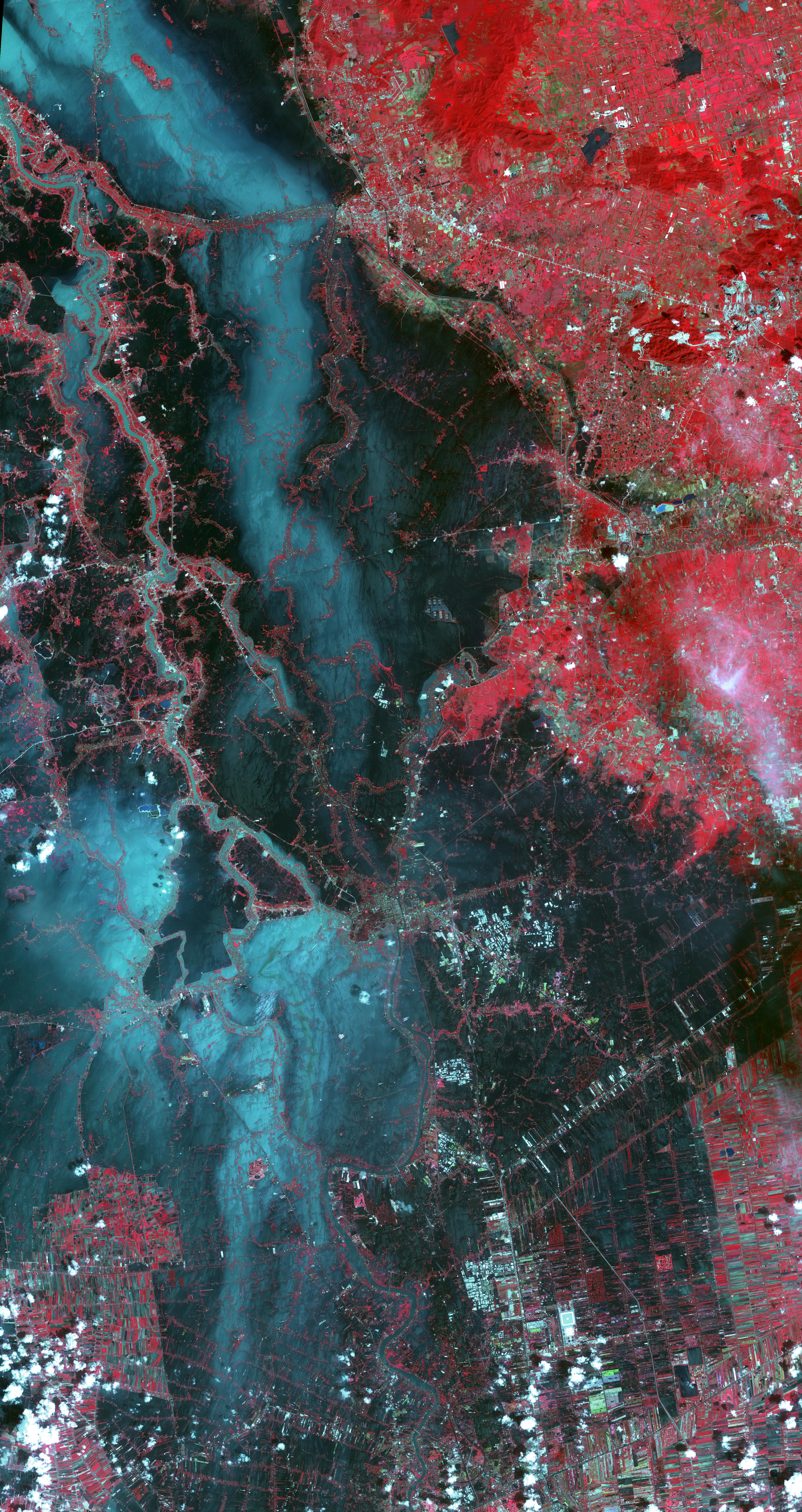
Since July 2011, heavy monsoon rains in southeast Asia have resulted in catastrophic flooding. In Thailand, about one third of all provinces are affected. On Oct. 23, 2011, when this image from the Advanced Spaceborne Thermal Emission and Reflection Radiometer (ASTER) instrument on NASA's Terra spacecraft was acquired, flood waters were approaching the capital city of Bangkok as the Ayutthaya River overflowed its banks. In this image, vegetation is displayed in red, and flooded areas are black and dark blue. Brighter blue shows sediment-laden water, and gray areas are houses, buildings and roads. The image covers an area of 35.2 by 66.3 miles (56.7 by 106.9 kilometers) and is located at 14.5 degrees north latitude, 100.5 degrees east longitude.
With its 14 spectral bands from the visible to the thermal infrared wavelength region and its high spatial resolution of 15 to 90 meters (about 50 to 300 feet), ASTER images Earth to map and monitor the changing surface of our planet. ASTER is one of five Earth-observing instruments launched Dec. 18, 1999, on Terra. The instrument was built by Japan's Ministry of Economy, Trade and Industry. A joint U.S./Japan science team is responsible for validation and calibration of the instrument and data products.
The broad spectral coverage and high spectral resolution of ASTER provides scientists in numerous disciplines with critical information for surface mapping and monitoring of dynamic conditions and temporal change. Example applications are: monitoring glacial advances and retreats; monitoring potentially active volcanoes; identifying crop stress; determining cloud morphology and physical properties; wetlands evaluation; thermal pollution monitoring; coral reef degradation; surface temperature mapping of soils and geology; and measuring surface heat balance.
The U.S. science team is located at NASA's Jet Propulsion Laboratory, Pasadena, Calif. The Terra mission is part of NASA's Science Mission Directorate, Washington, D.C.
More information about ASTER is available at http://asterweb.jpl.nasa.gov/.
