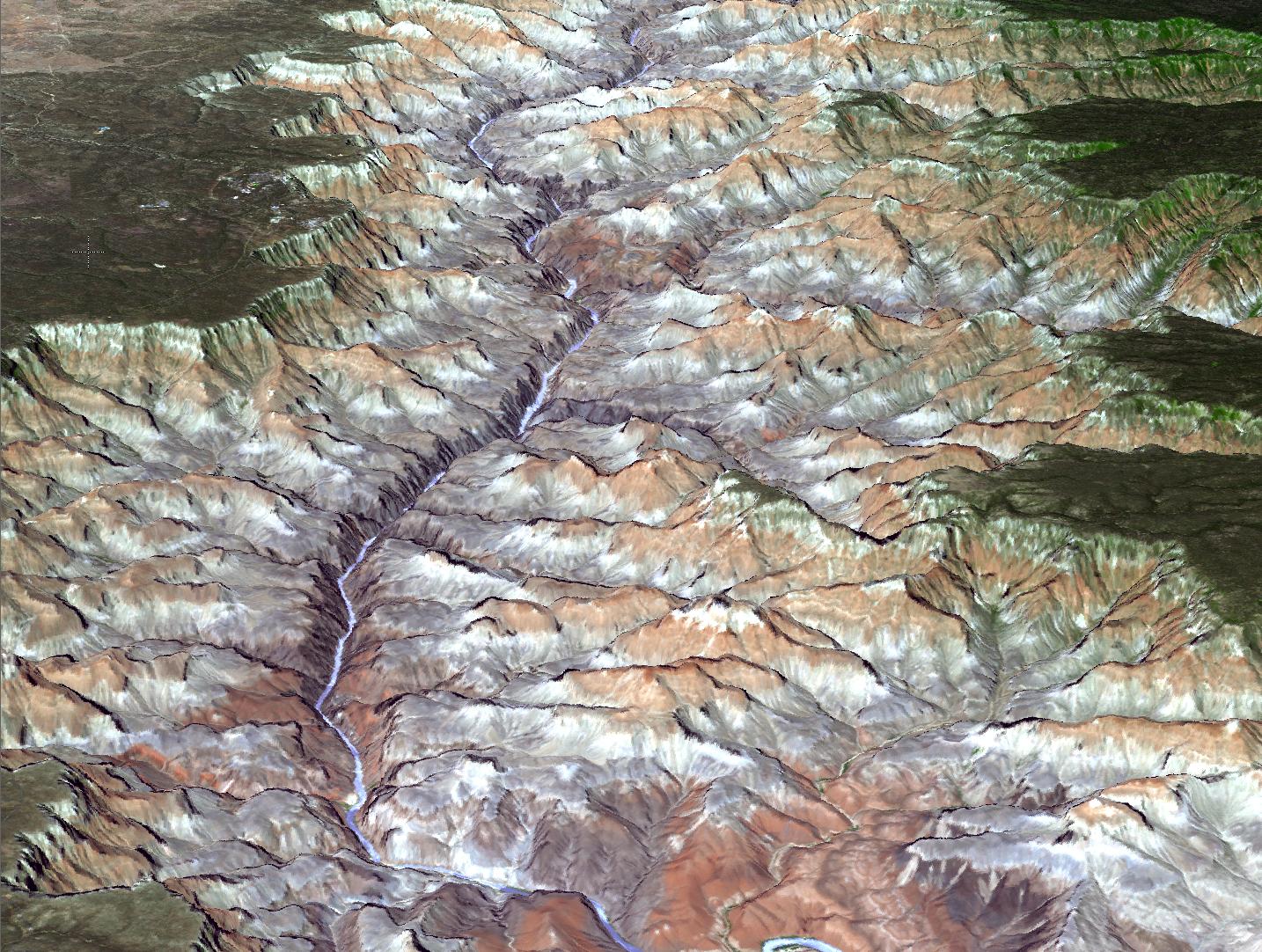
The Advanced Thermal Emission and Reflection Radiometer (ASTER) instrument on NASA's Terra spacecraft provided this spacebird's-eye view of the eastern part of Grand Canyon National Park in northern Arizona in this image, acquired July 14, 2011. In this perspective view looking to the west, the tourist facilities of Grand Canyon Village are visible in the upper left. The higher-elevation North Rim is seen on the right. The canyon is up to 9 miles (14.5 kilometers) wide and 5,600 feet (1,707 meters) deep, attesting to the power of moving water to carve Earth's surface. This 3-D view was created by draping the ASTER image over a Digital Elevation Model produced from ASTER stereo data .The ASTER image is located near 36 degrees north latitude, 112.1 degrees west longitude.
With its 14 spectral bands from the visible to the thermal infrared wavelength region and its high spatial resolution of 15 to 90 meters (about 50 to 300 feet), ASTER images Earth to map and monitor the changing surface of our planet. ASTER is one of five Earth-observing instruments launched Dec. 18, 1999, on Terra. The instrument was built by Japan's Ministry of Economy, Trade and Industry. A joint U.S./Japan science team is responsible for validation and calibration of the instrument and data products.
The broad spectral coverage and high spectral resolution of ASTER provides scientists in numerous disciplines with critical information for surface mapping and monitoring of dynamic conditions and temporal change. Example applications are: monitoring glacial advances and retreats; monitoring potentially active volcanoes; identifying crop stress; determining cloud morphology and physical properties; wetlands evaluation; thermal pollution monitoring; coral reef degradation; surface temperature mapping of soils and geology; and measuring surface heat balance.
The U.S. science team is located at NASA's Jet Propulsion Laboratory, Pasadena, Calif. The Terra mission is part of NASA's Science Mission Directorate, Washington, D.C.
More information about ASTER is available at http://asterweb.jpl.nasa.gov/.
