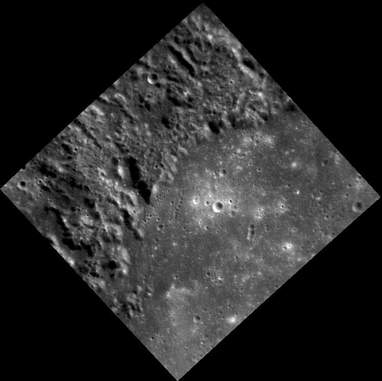
Taken with the Narrow Angle Camera (NAC), this image shows part of the impact basin Petrarch, named for the 14th century Italian scholar, poet, and "Father of Humanism" Francesco Petrarca. Much of the surface near Petrarch is unusually rough and textured. The Mariner 10 team informally dubbed this surface "weird terrain" (though it was later named "hilly and lineated terrain" for official geologic maps). MESSENGER imaged this region during the mission's second Mercury flyby as well as a portion of it early in the orbital mission.
This image was acquired as part of MDIS's high-resolution surface morphology base map. The surface morphology base map will cover more than 90% of Mercury's surface with an average resolution of 250 meters/pixel (0.16 miles/pixel or 820 feet/pixel). Images acquired for the surface morphology base map typically have off-vertical Sun angles (i.e., high incidence angles) and visible shadows so as to reveal clearly the topographic form of geologic features.
The MESSENGER spacecraft is the first ever to orbit the planet Mercury, and the spacecraft's seven scientific instruments and radio science investigation are unraveling the history and evolution of the Solar System's innermost planet. Visit the Why Mercury? section of this website to learn more about the key science questions that the MESSENGER mission is addressing. During the one-year primary mission, MDIS is scheduled to acquire more than 75,000 images in support of MESSENGER's science goals.
Date acquired: September 02, 2011
Image Mission Elapsed Time (MET): 223444635
Image ID: 708150
Instrument: Narrow Angle Camera (NAC) of the Mercury Dual Imaging System (MDIS)
Center Latitude: -29.60°
Center Longitude: 332.1° E
Resolution: 182 meters/pixel
Scale: From the left point to the right point, this image is about 135 km (84 miles) wide.
Incidence Angle: 39.6°
Emission Angle: 18.8°
Phase Angle: 58.4°
These images are from MESSENGER, a NASA Discovery mission to conduct the first orbital study of the innermost planet, Mercury. For information regarding the use of images, see the MESSENGER image use policy.
