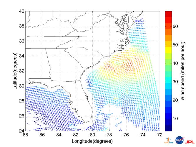
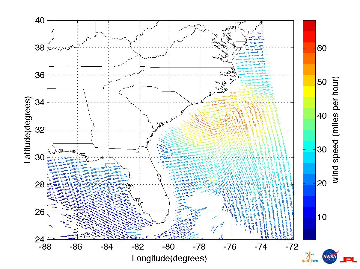
Hurricane Irene made landfall early Saturday morning, Aug. 27, just west of Cape Lookout, NC, as a category one hurricane with maximum sustained winds of 85 mph (75 knots). It is currently over eastern North Carolina and is forecast to gradually weaken as it moves northward along the East Coast of the United States over the next two days.
This satellite image of Hurricane Irene, showing the storm's ocean surface wind speed and direction, was acquired at 1:07 a.m. EDT on Aug. 27, approximately six hours before it hit the North Carolina coast. The data are provided courtesy of the Indian Space Research Organization (ISRO) from the OSCAT instrument on ISRO's Oceansat-2 spacecraft, launched in September 2009. Wind vector data processing was performed at NASA's Jet Propulsion Laboratory, Pasadena, Calif. The OSCAT winds are obtained at 15-by-15-mile (25-by-25-kilometer) resolution and do not resolve the hurricane's maximum wind speeds, which occur at much finer scales.
Since NASA's QuikScat ocean wind satellite ceased nominal operations in November 2009, scientists and engineers from NASA, JPL, and the National Oceanic and Atmospheric Administration (NOAA) have collaborated with ISRO in ongoing efforts to calibrate and validate OSCAT measurements in order to ensure continuous coverage of ocean vector winds for use by the global weather forecasting and climate community.
More on NASA's hurricane research and Irene is online at NASA's hurricanes/tropical cyclones website http://www.nasa.gov/mission_pages/hurricanes/main/index.html and the JPL TC-IDEAS hurricane website http://hurricanes.jpl.nasa.gov.