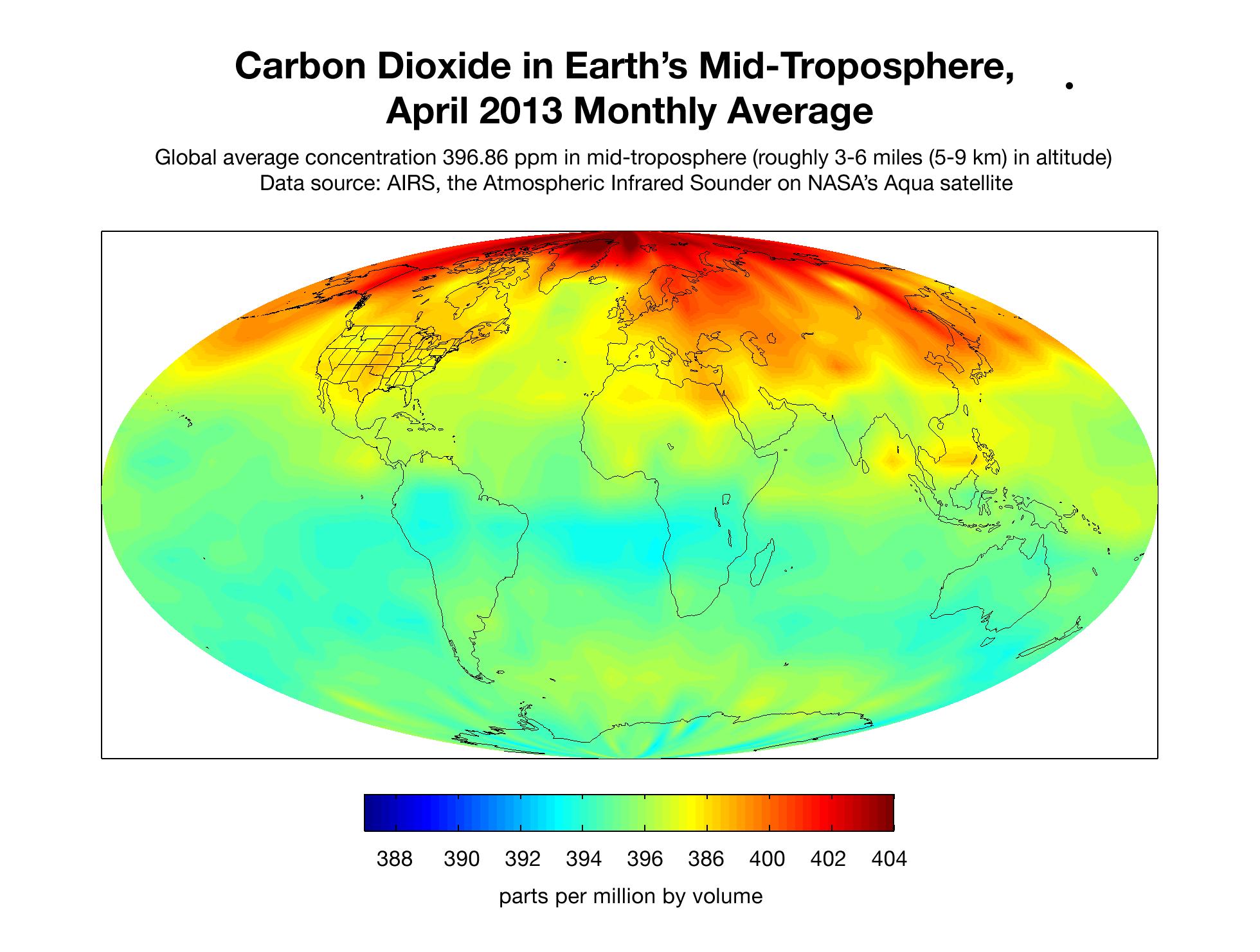
This map created with data from the Atmospheric Infrared Sounder (AIRS) on NASA's Aqua satellite shows the concentration of carbon dioxide in Earth's mid-troposphere, located roughly between 3 to 6 miles (5 to 9 kilometers) in altitude. Darker red colors correspond to higher concentrations of carbon dioxide, which are seen mostly in the northern latitudes. This is a typical pattern for this time of year, which follows the die-off of vegetation in winter when soil and plants release carbon dioxide into the atmosphere. Much of the regional variability seen in this map is due to weather patterns that move higher concentrations of carbon dioxide from Earth's surface into and out of the mid-troposphere where the AIRS instrument detects carbon dioxide best. The concentration of carbon dioxide in the mid-troposphere lags the concentration found at the surface as mixing from the lower to upper altitudes usually takes days to weeks. In addition, changes in concentration of carbon dioxide at Earth's surface are not always carried up to higher altitudes.
About AIRS
The Atmospheric Infrared Sounder, AIRS, in conjunction with the Advanced Microwave Sounding Unit, AMSU, senses emitted infrared and microwave radiation from Earth to provide a three-dimensional look at Earth's weather and climate. Working in tandem, the two instruments make simultaneous observations all the way down to Earth's surface, even in the presence of heavy clouds. With more than 2,000 channels sensing different regions of the atmosphere, the system creates a global, three-dimensional map of atmospheric temperature and humidity, cloud amounts and heights, greenhouse gas concentrations, and many other atmospheric phenomena. Launched into Earth orbit in 2002, the AIRS and AMSU instruments fly onboard NASA's Aqua spacecraft and are managed by NASA's Jet Propulsion Laboratory in Pasadena, Calif., under contract to NASA. JPL is a division of the California Institute of Technology in Pasadena.
More information about AIRS can be found at http://airs.jpl.nasa.gov.
 Planetary Data System


