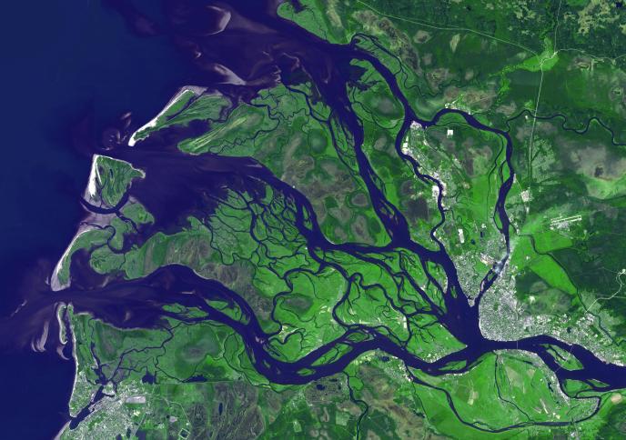
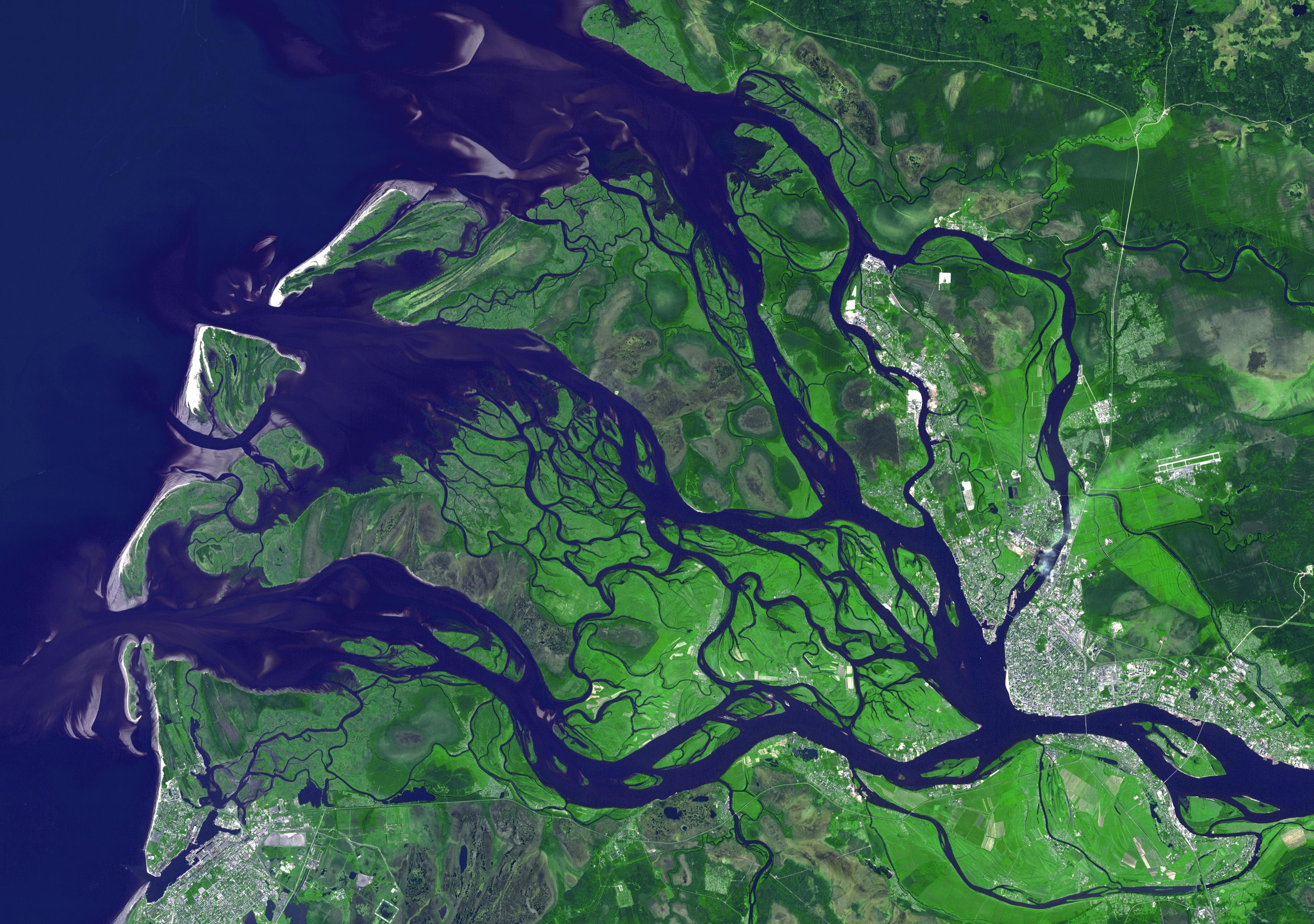
Arkhangelsk (or Archangel in English) is a city and the administrative capital of Archangelsk Oblast, Russia. It is situated on both banks of the Dvina River near where it flows into the White Sea. As early as 800 the area was known to the Vikings to have a settlement, that they raided around 1000. In the 12th century, the Novogordians established the Archangel Michael Monastery. For the next 400 years, conflict between Russia and Sweden for control of the White Sea and the Kola Peninsula led to shifting rulers for Arkhangelsk. Construction of a railway to Moscow in the late 1800s signaled a revival of the city's economy. During both world wars, Arkhangelsk was a major port of entry for Allied aid. The image was acquired July 14, 2010, covers an area of 37.3 x 53.1 km, and is located at 64.5 degrees north latitude, 40.5 degrees east longitude.
With its 14 spectral bands from the visible to the thermal infrared wavelength region and its high spatial resolution of 15 to 90 meters (about 50 to 300 feet), ASTER images Earth to map and monitor the changing surface of our planet. ASTER is one of five Earth-observing instruments launched Dec. 18, 1999, on Terra. The instrument was built by Japan's Ministry of Economy, Trade and Industry. A joint U.S./Japan science team is responsible for validation and calibration of the instrument and data products.
The broad spectral coverage and high spectral resolution of ASTER provides scientists in numerous disciplines with critical information for surface mapping and monitoring of dynamic conditions and temporal change. Example applications are: monitoring glacial advances and retreats; monitoring potentially active volcanoes; identifying crop stress; determining cloud morphology and physical properties; wetlands evaluation; thermal pollution monitoring; coral reef degradation; surface temperature mapping of soils and geology; and measuring surface heat balance.
The U.S. science team is located at NASA's Jet Propulsion Laboratory, Pasadena, Calif. The Terra mission is part of NASA's Science Mission Directorate, Washington, D.C.
More information about ASTER is available at http://asterweb.jpl.nasa.gov/.