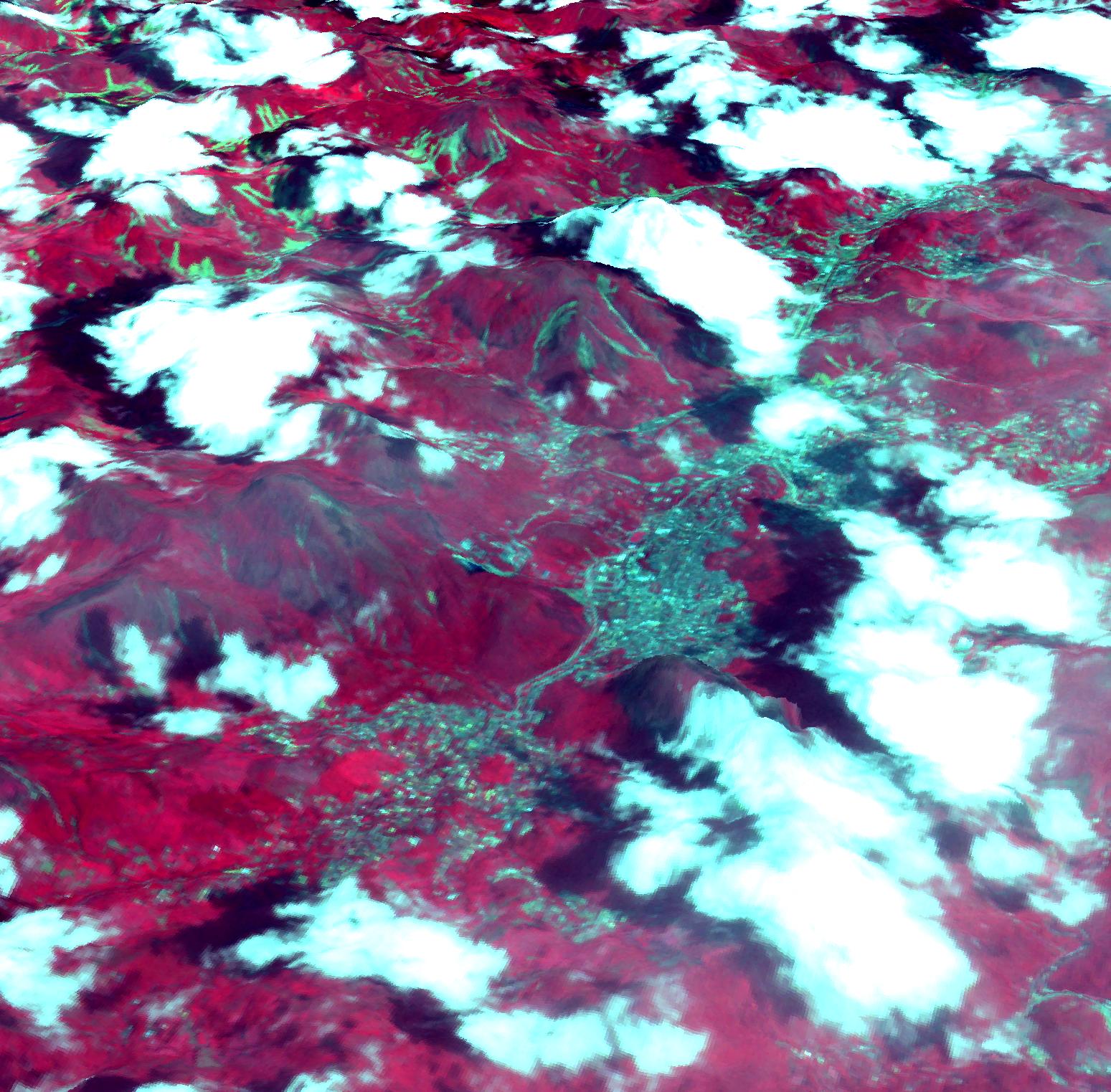
On Jan. 18, 2011, the Advanced Spaceborne Thermal Emission and Reflection Radiometer (ASTER) instrument on NASA's Terra spacecraft captured this image of the city of Nova Friburgo, Brazil. A week of torrential rains triggered a series of deadly mudslides and floods in several mountaintop towns about 100 kilometers (60 miles) north of Rio de Janeiro. Several areas saw more than 25 centimeters (10 inches) of rain in less than 24 hours. Thousands of residents have been left homeless, and more than 700 people are reported dead. This 3-D perspective image was created by draping an ASTER image over an ASTER-derived digital elevation model. In this rendition, vegetation is red, numerous clouds are white, houses and roads are light blue, and exposed terracotta soils are blue-green, including recent landslides. The image is located at 22.3 degrees south latitude, 42.5 degrees west longitude.
With its 14 spectral bands from the visible to the thermal infrared wavelength region and its high spatial resolution of 15 to 90 meters (about 50 to 300 feet), ASTER images Earth to map and monitor the changing surface of our planet. ASTER is one of five Earth-observing instruments launched Dec. 18, 1999, on Terra. The instrument was built by Japan's Ministry of Economy, Trade and Industry. A joint U.S./Japan science team is responsible for validation and calibration of the instrument and data products.
The broad spectral coverage and high spectral resolution of ASTER provides scientists in numerous disciplines with critical information for surface mapping and monitoring of dynamic conditions and temporal change. Example applications are: monitoring glacial advances and retreats; monitoring potentially active volcanoes; identifying crop stress; determining cloud morphology and physical properties; wetlands evaluation; thermal pollution monitoring; coral reef degradation; surface temperature mapping of soils and geology; and measuring surface heat balance.
The U.S. science team is located at NASA's Jet Propulsion Laboratory, Pasadena, Calif. The Terra mission is part of NASA's Science Mission Directorate, Washington, D.C.
More information about ASTER is available at http://asterweb.jpl.nasa.gov/.
