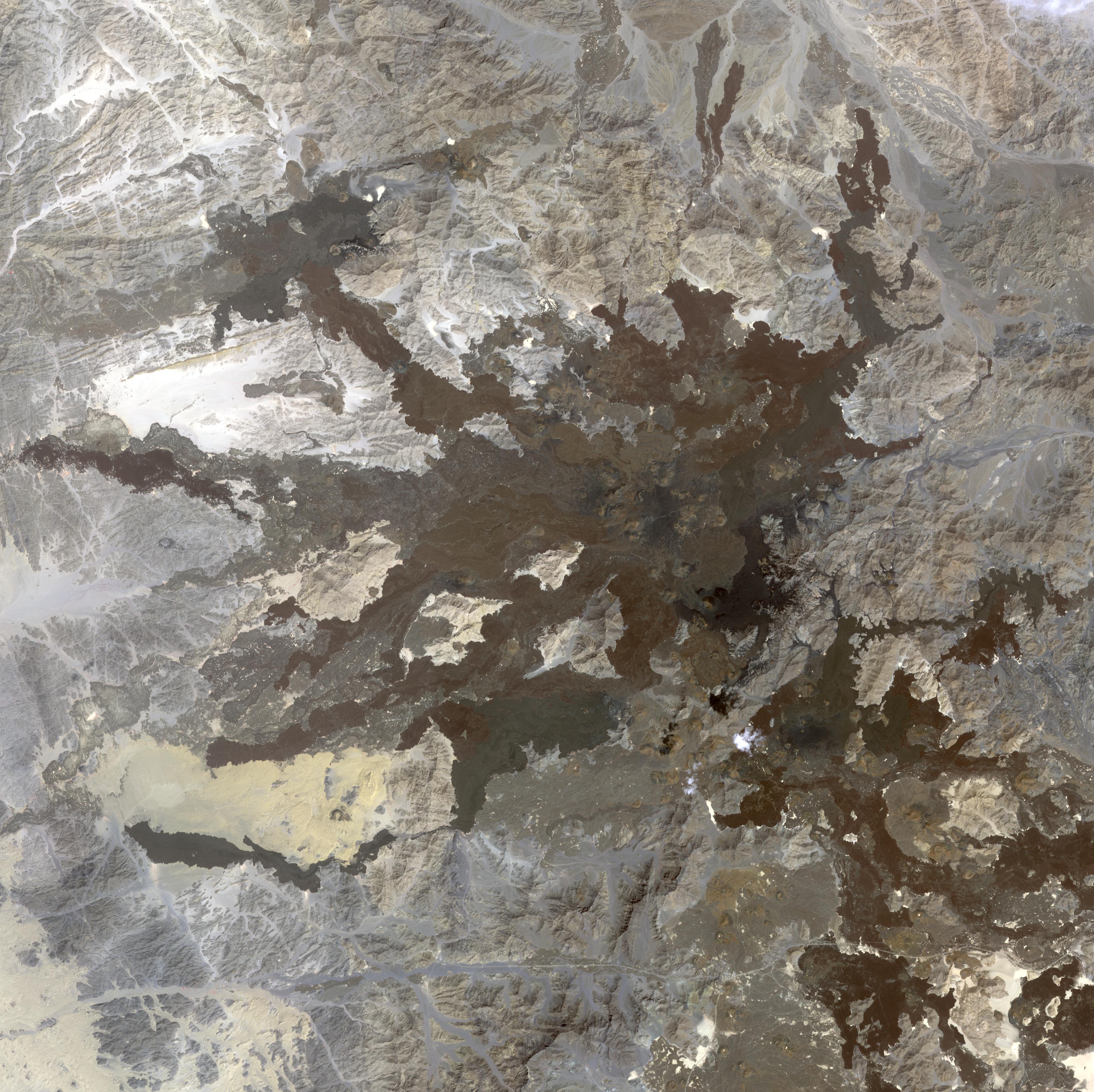
A swarm of thousands of earthquakes that struck the corner of Saudi Arabia nearest to Egypt in 2009 helped reveal that the area is unexpectedly volcanically active. Scientists had largely thought northwest Saudi Arabia was quiet, geologically speaking. Few earthquakes and few volcanic eruptions have been recorded there in the past millennium. However, between April and June 2009, more than 30,000 micro-earthquakes struck an ancient lava field there named Harrat Lunayyir, with 19 earthquakes of magnitude 4 or greater, including one quake that fractured walls at a nearby town. The image was acquired October 8, 2006, covers an area of 57 x 57 km, and is located near 25.2 degrees north latitude, 37.8 degrees east longitude.
With its 14 spectral bands from the visible to the thermal infrared wavelength region and its high spatial resolution of 15 to 90 meters (about 50 to 300 feet), ASTER images Earth to map and monitor the changing surface of our planet. ASTER is one of five Earth-observing instruments launched Dec. 18, 1999, on Terra. The instrument was built by Japan's Ministry of Economy, Trade and Industry. A joint U.S./Japan science team is responsible for validation and calibration of the instrument and data products.
The broad spectral coverage and high spectral resolution of ASTER provides scientists in numerous disciplines with critical information for surface mapping and monitoring of dynamic conditions and temporal change. Example applications are: monitoring glacial advances and retreats; monitoring potentially active volcanoes; identifying crop stress; determining cloud morphology and physical properties; wetlands evaluation; thermal pollution monitoring; coral reef degradation; surface temperature mapping of soils and geology; and measuring surface heat balance.
The U.S. science team is located at NASA's Jet Propulsion Laboratory, Pasadena, Calif. The Terra mission is part of NASA's Science Mission Directorate, Washington, D.C.
More information about ASTER is available at http://asterweb.jpl.nasa.gov/.
 Planetary Data System


