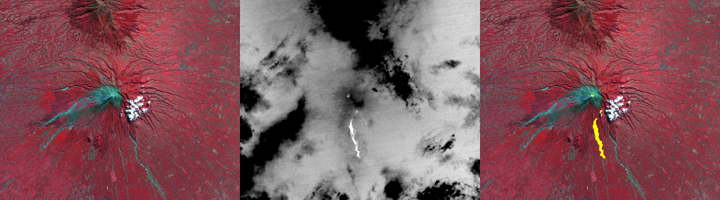
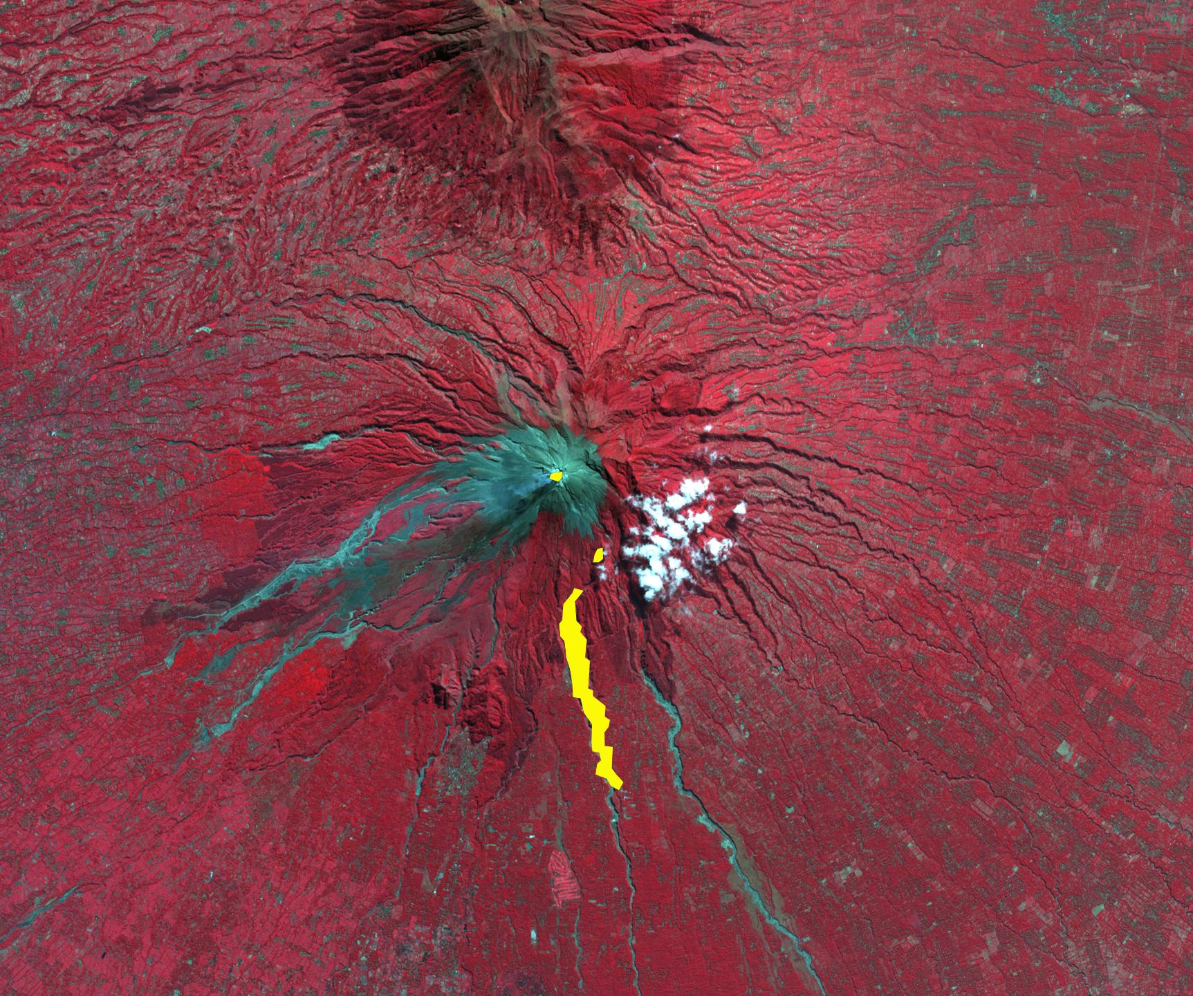
Figure 1
Click on the image for larger versionOn Oct. 26, 2010, Merapi volcano in Indonesia erupted, killing at least 38 people and prompting authorities to evacuate tens of thousands of inhabitants from around the mountain. On the night of November 1, the Advanced Spaceborne Thermal Emission and Reflection Radiometer (ASTER) instrument on NASA's Terra spacecraft captured a thermal infrared image (center Figure 1) of the hot volcanic flow that resulted from collapse of the summit lava dome, and that led to the ensuing release of ash plumes (center Figure 1; hot areas are brightest). In the daytime image from 2003 (left Figure 1), vegetation is displayed in red, and older volcanic flows are in blue-gray. The composite image on the right superposes the hot flow and summit dome areas from 2010 in yellow on top of the 2003 image. Gaps in the hot areas are due to concealment by intervening clouds in the 2010 night infrared image.The ASTER image is located at 7.5 degrees south latitude, 110.5 degrees east longitude. The image covers an area of 17 by 19 kilometers (11 by 12 miles).
With its 14 spectral bands from the visible to the thermal infrared wavelength region and its high spatial resolution of 15 to 90 meters (about 50 to 300 feet), ASTER images Earth to map and monitor the changing surface of our planet. ASTER is one of five Earth-observing instruments launched Dec. 18, 1999, on Terra. The instrument was built by Japan's Ministry of Economy, Trade and Industry. A joint U.S./Japan science team is responsible for validation and calibration of the instrument and data products.
The broad spectral coverage and high spectral resolution of ASTER provides scientists in numerous disciplines with critical information for surface mapping and monitoring of dynamic conditions and temporal change. Example applications are: monitoring glacial advances and retreats; monitoring potentially active volcanoes; identifying crop stress; determining cloud morphology and physical properties; wetlands evaluation; thermal pollution monitoring; coral reef degradation; surface temperature mapping of soils and geology; and measuring surface heat balance.
The U.S. science team is located at NASA's Jet Propulsion Laboratory, Pasadena, Calif. The Terra mission is part of NASA's Science Mission Directorate, Washington, D.C.
More information about ASTER is available at http://asterweb.jpl.nasa.gov/.

