Originally released Oct. 8, 2010.
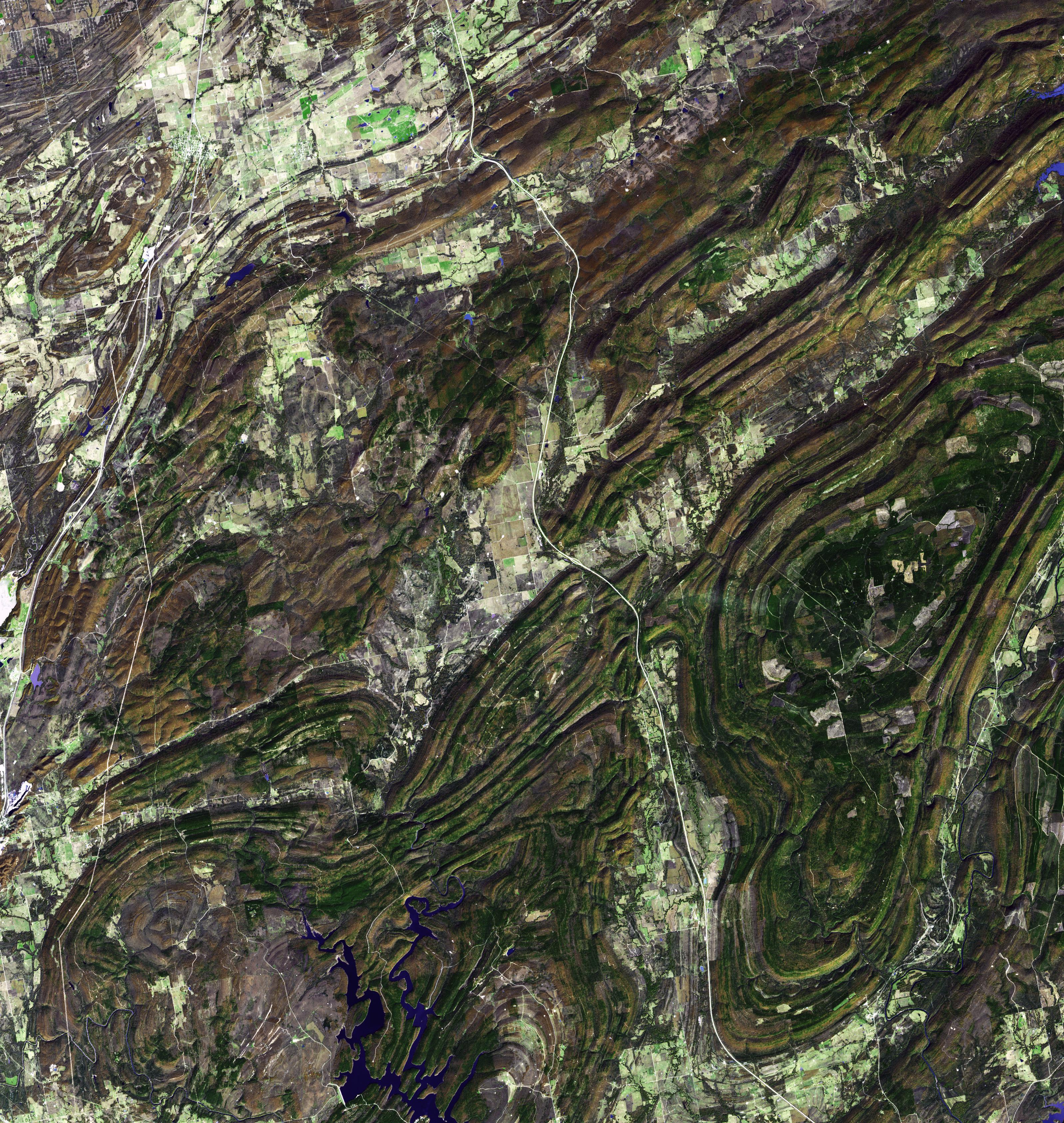
The Ouachita Mountains in southeast Oklahoma are part of the only major mountainous region between the Rockies and the Appalachians. The Ouachitas are fold mountains, formed about 300 million years ago when the South American Plate drifted northward, colliding with the North American Plate. The first recorded exploration by Europeans was in 1521 by Hernando de Soto. Forming part of the Louisiana Purchase, President Jefferson sent William Dunbar and Dr. George Hunter to reconnoiter the area. The image was acquired November 13, 2002, covers an area of 48 x 50 km, and is located at 34.6 degrees north latitude, 95.8 degrees west longitude.
With its 14 spectral bands from the visible to the thermal infrared wavelength region and its high spatial resolution of 15 to 90 meters (about 50 to 300 feet), ASTER images Earth to map and monitor the changing surface of our planet. ASTER is one of five Earth-observing instruments launched Dec. 18, 1999, on Terra. The instrument was built by Japan's Ministry of Economy, Trade and Industry. A joint U.S./Japan science team is responsible for validation and calibration of the instrument and data products.
The broad spectral coverage and high spectral resolution of ASTER provides scientists in numerous disciplines with critical information for surface mapping and monitoring of dynamic conditions and temporal change. Example applications are: monitoring glacial advances and retreats; monitoring potentially active volcanoes; identifying crop stress; determining cloud morphology and physical properties; wetlands evaluation; thermal pollution monitoring; coral reef degradation; surface temperature mapping of soils and geology; and measuring surface heat balance.
The U.S. science team is located at NASA's Jet Propulsion Laboratory, Pasadena, Calif. The Terra mission is part of NASA's Science Mission Directorate, Washington, D.C.
More information about ASTER is available at http://asterweb.jpl.nasa.gov/.
