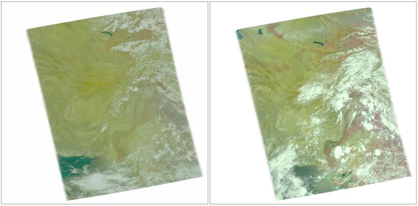
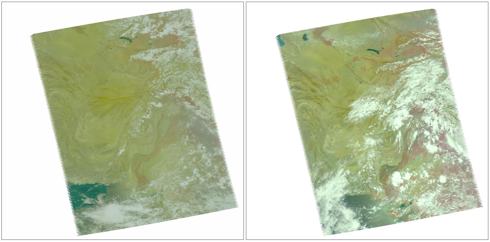
In late July 2010, flooding caused by heavy monsoon rains began in several regions of Pakistan, including the Khyber Pakhtunkhwa, Sindh, Punjab and parts of Baluchistan. According to the Associated Press, the floods have affected about one-fifth of the country. Tens of thousands of villages have been flooded, more than 1,500 people have been killed, and millions have been left homeless. The floodwaters are not expected to fully recede before late August. These two false-color images of the region were taken by the Atmospheric Infrared Sounder (AIRS) instrument on NASA's Aqua spacecraft, using the instrument's four visible and near-infrared channels. The images include southern Pakistan, including the Sindh Province. The Indus River appears to enter from the upper right and winds southwestward toward the lower left. The image at left was taken before the flooding on July 9, 2010, while the image on the right was taken Aug. 10, 2010. Both were taken at 1:30 p.m. local time. The spatial resolution of the images is 14 kilometers (8.5 miles), and each image covers an area measuring 1,650 by 1,980 kilometers (1,023 by 1,228 miles).
About AIRS
The Atmospheric Infrared Sounder, AIRS, in conjunction with the Advanced Microwave Sounding Unit, AMSU, senses emitted infrared and microwave radiation from Earth to provide a three-dimensional look at Earth's weather and climate. Working in tandem, the two instruments make simultaneous observations all the way down to Earth's surface, even in the presence of heavy clouds. With more than 2,000 channels sensing different regions of the atmosphere, the system creates a global, three-dimensional map of atmospheric temperature and humidity, cloud amounts and heights, greenhouse gas concentrations, and many other atmospheric phenomena. Launched into Earth orbit in 2002, the AIRS and AMSU instruments fly onboard NASA's Aqua spacecraft and are managed by NASA's Jet Propulsion Laboratory in Pasadena, Calif., under contract to NASA. JPL is a division of the California Institute of Technology in Pasadena.
More information about AIRS can be found at http://airs.jpl.nasa.gov.
 Planetary Data System


