In late July 2010, flooding caused by heavy monsoon rains began in several regions of Pakistan, including the Khyber Pakhtunkhwa, Sindh, Punjab and parts of Baluchistan. According to the Associated Press, the floods have affected about one-fifth of the country. Tens of thousands of villages have been flooded, more than 1,500 people have been killed, and millions have been left homeless. The floodwaters are not expected to fully recede before late August.
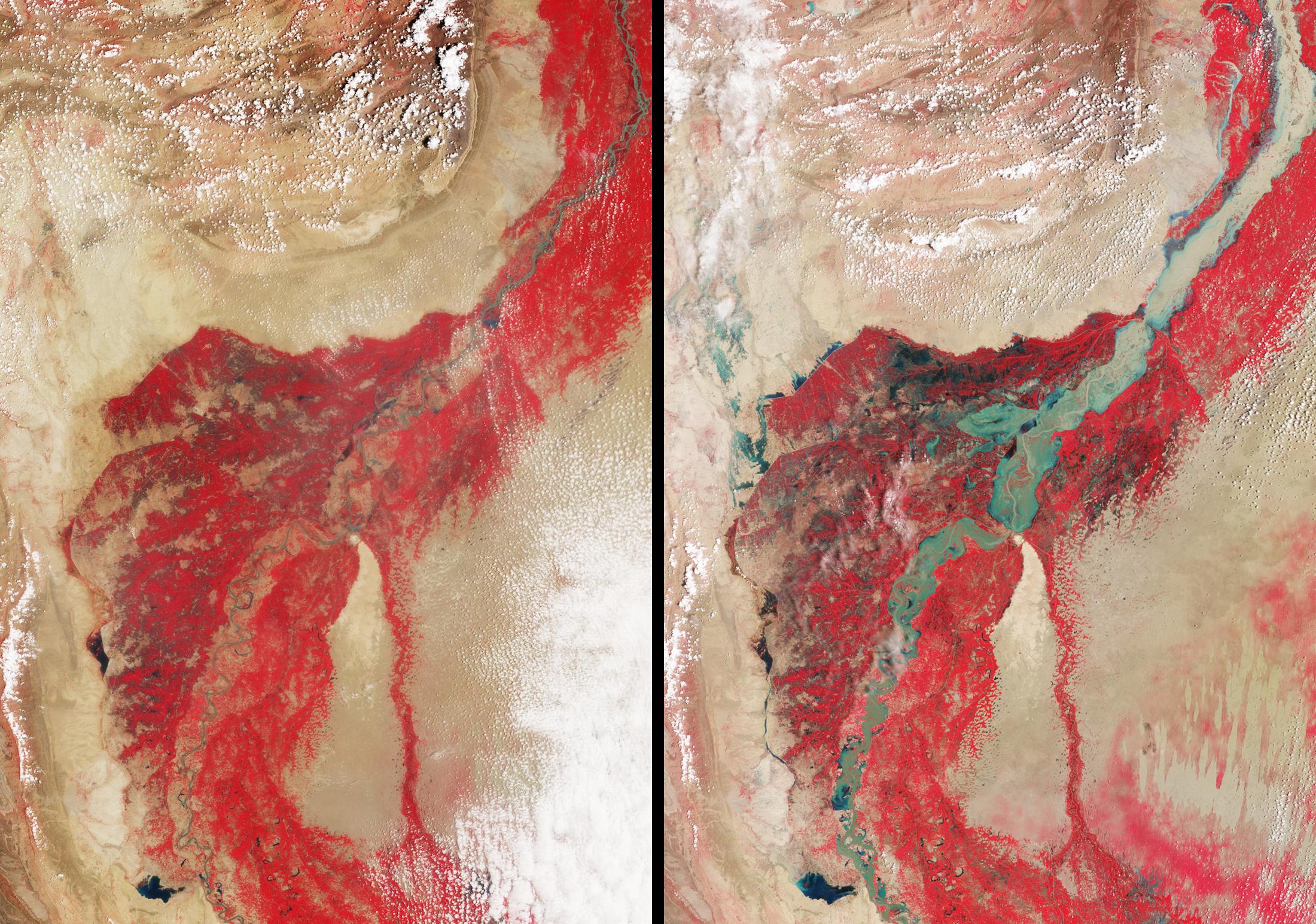
This image pair of the affected region was acquired by the nadir (vertical-viewing) camera on the Multi-angle Imaging SpectroRadiometer (MISR) instrument aboard NASA's Terra spacecraft. The image on the left is from Aug. 8, 2009, and the one on the right is from Aug. 11, 2010. These false-color views display the near-infrared, red and green bands of the instrument as red-green-blue. This distinctly highlights the contrast between the water and vegetation on the river banks, because vegetation appears bright in the near-infrared region of the electromagnetic spectrum.
The region of southern Pakistan shown here includes the Sindh Province. The Indus River can be seen snaking across the image from lower left to upper right. The feature near the bottom and left of center is Manchhar Lake. Water is apparent in shades of blue and cyan, though sediment content can add a tan color, as in the upper right. Clouds appear white. Dimensions of each panel are 300 by 425 kilometers (186 by 264 miles). In the image from 2009, the Indus is typically about 1 kilometer (0.6 mile) wide. In the 2010 image, the river is 23 kilometers (14 miles) wide or more in spots, and flooding in much of the surrounding region, particularly in the Larkana District to the west of the river, is very evident.
MISR was built and is managed by NASA's Jet Propulsion Laboratory, Pasadena, Calif., for NASA's Science Mission Directorate, Washington, D.C. The Terra spacecraft is managed by NASA's Goddard Space Flight Center, Greenbelt, Md. The MISR data were obtained from the NASA Langley Research Center Atmospheric Science Data Center in Hampton, Va. JPL is a division of the California Institute of Technology.
