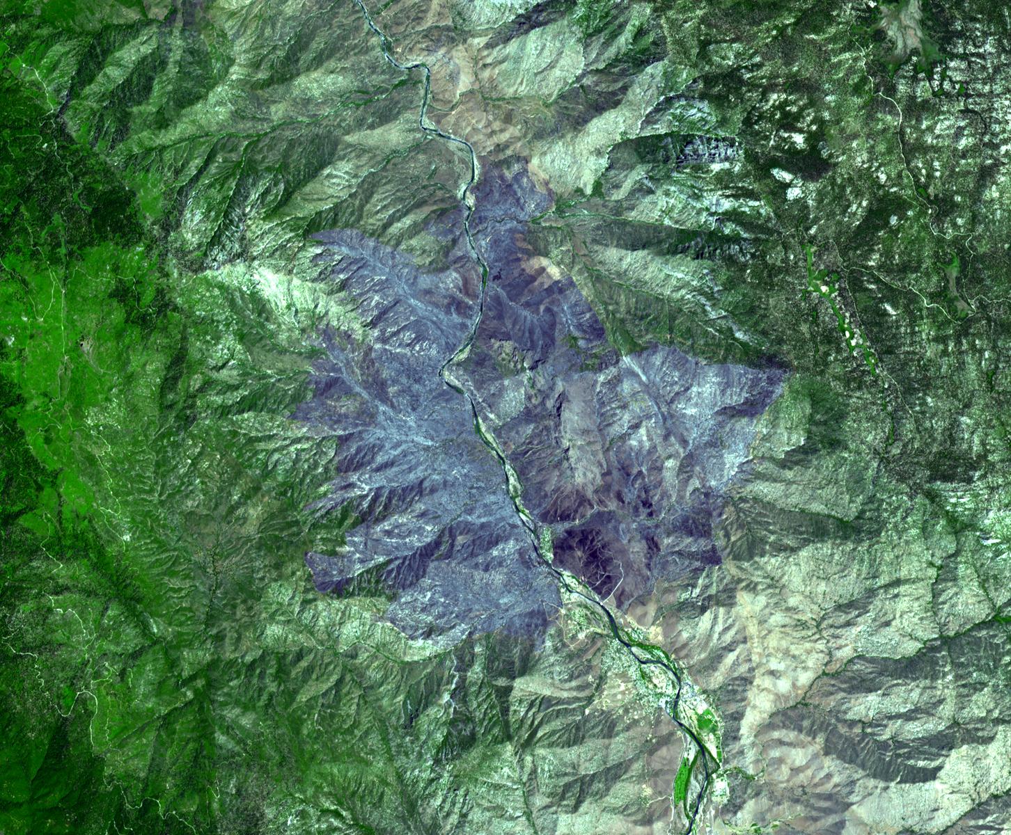
The Advanced Spaceborne Thermal Emission and Reflection Radiometer (ASTER) instrument on NASA's Terra spacecraft captured this image of the wildfire near Palmdale, Calif. on August 1, 2010. Called the Crown fire, the blaze had charred nearly 57 square kilometers (22 square miles, or 14,000 acres) of brush in Palmdale, north of Los Angeles, as of August 2. Higher humidity and lower temperatures allowed firefighters to contain 89 percent of the fire by August 2. The fire began July 29 in the Agua Dulce area. This ASTER image covers an area measuring 18 by 21.8 kilometers (11.2 by 13.5 miles). The burned areas appear in shades of gray in this simulated natural color image.
With its 14 spectral bands from the visible to the thermal infrared wavelength region and its high spatial resolution of 15 to 90 meters (about 50 to 300 feet), ASTER images Earth to map and monitor the changing surface of our planet. ASTER is one of five Earth-observing instruments launched December 18, 1999, on NASA's Terra spacecraft. The instrument was built by Japan's Ministry of Economy, Trade and Industry. A joint U.S./Japan science team is responsible for validation and calibration of the instrument and the data products.
The broad spectral coverage and high spectral resolution of ASTER provides scientists in numerous disciplines with critical information for surface mapping and monitoring of dynamic conditions and temporal change. Example applications are: monitoring glacial advances and retreats; monitoring potentially active volcanoes; identifying crop stress; determining cloud morphology and physical properties; wetlands evaluation; thermal pollution monitoring; coral reef degradation; surface temperature mapping of soils and geology; and measuring surface heat balance.
The ASTER U.S. science team is located at NASA's Jet Propulsion Laboratory, Pasadena, Calif. The Terra mission is part of NASA's Science Mission Directorate, Washington, D.C.
More information about ASTER is available at http://asterweb.jpl.nasa.gov/.
