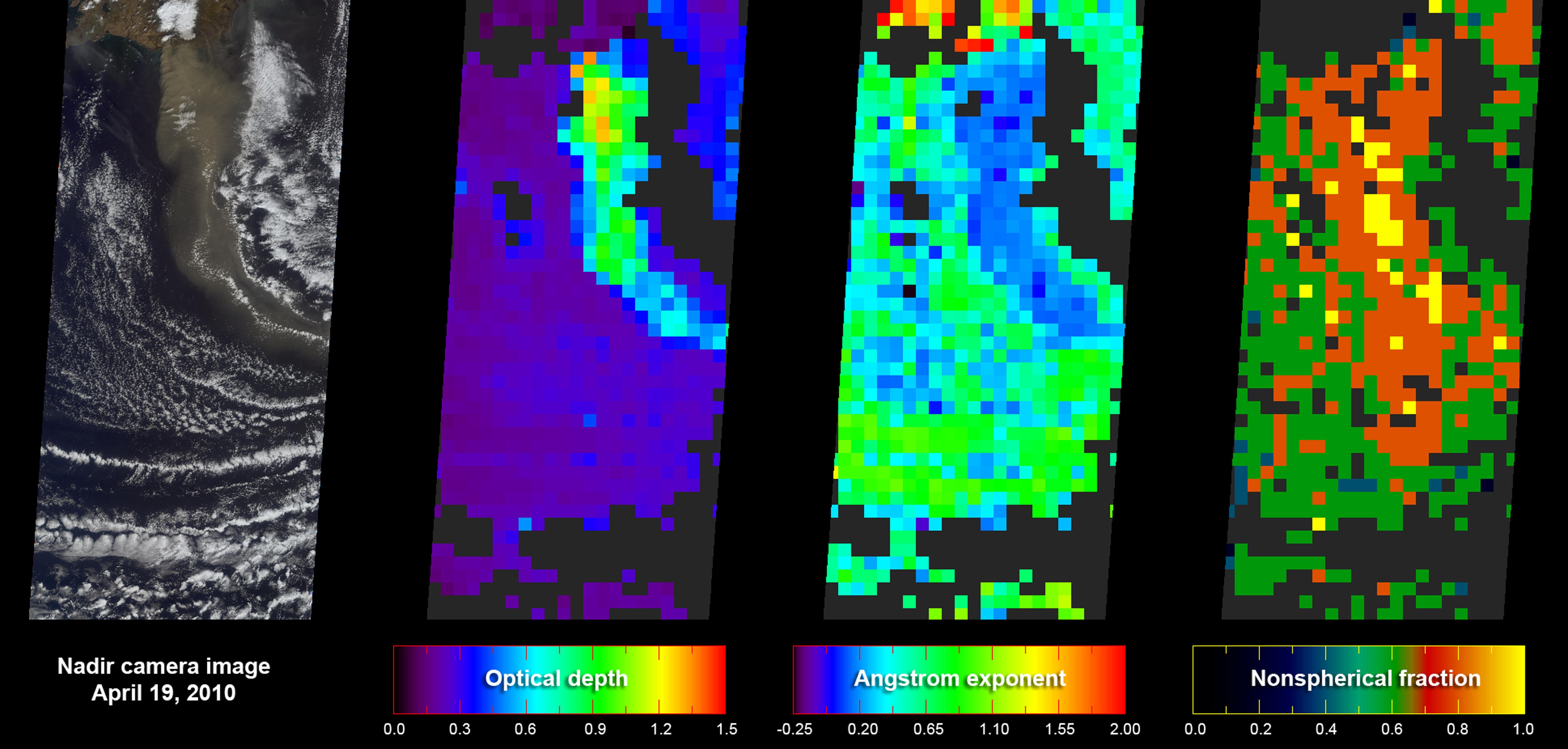
As NASA's Terra satellite flew over Iceland's erupting Eyjafjallajökull volcano on April 19, 2010, its Multi-angle Imaging SpectroRadiometer (MISR) instrument acquired 36 near-simultaneous images of the ash plume, covering nine view angles in each of four wavelengths. From these observations, the extent of the plume is easily visible, but in addition, the amount and type of particles in the plume itself can be derived.
The leftmost panel of this figure gives a true-color nadir (vertical) view of the scene, with the plume emanating from the cloud-enshrouded volcano in the top-center of the image, heading south to southeast. The next panel covers the same area, and gives a map of retrieved aerosol optical depth, a measure of the amount of particulate matter in the atmosphere. The plume here is about five times thicker than the background aerosol. The third panel reports the Angstrom exponent, which is related to average particle size -- bigger particles generally have smaller Angstrom exponents. In this case, the volcanic plume contains distinctly larger particles than the surrounding atmosphere. The final panel reports particle shape. Volcanic ash is composed primarily of angular, non-spherical particles, whereas background maritime particles are typically tiny spherical liquid droplets. In the last panel, the plume stands out relative to the unperturbed air as being composed of close to 100 percent non-spherical particles, the kind that create concern for jet aircraft safety.
Each panel covers an area 380 kilometers wide by 842 kilometers high (236 miles wide by 523 miles high). The resolution of the nadir image in the first panel is 1.1 kilometers (0.7 miles); aerosol amount and type in the other three panels are given at 17.6 kilometers (10.9 miles) per pixel. MISR has been acquiring aerosol information routinely for the past 10 years, covering the entire globe about once per week.
MISR was built and is managed by NASA's Jet Propulsion Laboratory, Pasadena, Calif., for NASA's Science Mission Directorate, Washington, D.C. The Terra satellite is managed by NASA's Goddard Space Flight Center, Greenbelt, Md. The MISR data were obtained from the NASA Langley Research Center Atmospheric Science Data Center. JPL is a division of the California Institute of Technology.
