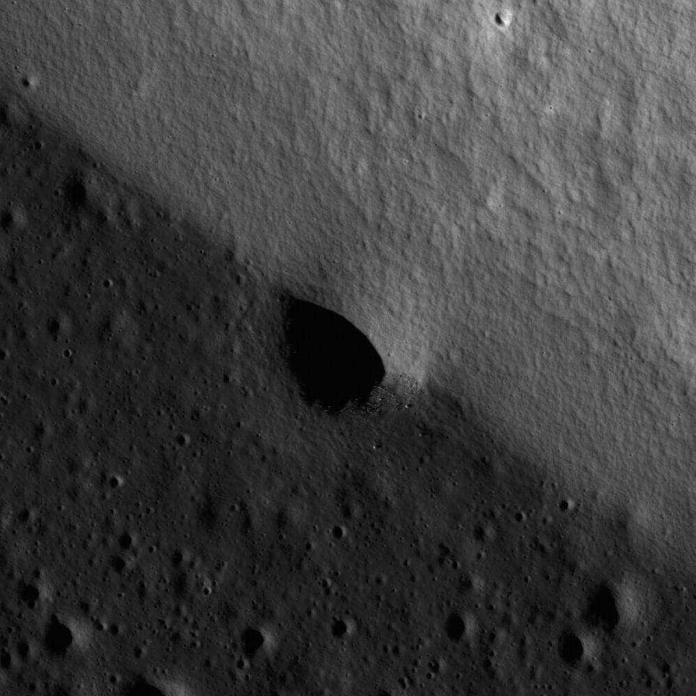
A mare-highlands boundary in northern Mare Frigoris. Image width is 1.8 km.
Detail from a NAC frame centered on an impact crater that formed on the contact between two different geologic units: a highland massif (lighter gray, higher albedo, top-right side of image) and mare lava flows (darker gray, lower albedo, bottom-left side of image) in northern Mare Frigoris. Contacts such as this one are important to geologists because they provide information on the relative time of formation between the features. In this example, the lava flowed against the pre-existing massif, so we can infer that the lava flows are younger. The crater formed across both the massif and the lava flows, therefore we can infer this impact event occurred after the volcanic eruptions that formed the lava flows. Notice that the rim of the crater is no longer discernible on the massiff side because it is partially buried by material from the steep slope that has slumped down after the crater formed. The crater rim is more prominent along the side with the lava flows, because this area is flat and stable. Boulders are also more prominent along the crater wall within the lava flow versus the part of the crater wall along the massif because any boulders that may have ben on the rim were buried by slumping. A quick analysis of this small area illustrates the principles of stratigraphy used by geologists to unravel the geologic history of a location. The same stratigraphic principles are applied on a regional scale to create geologic maps of the lunar surface which are important for determining the timing of events that shaped the Moon.
NASA's Goddard Space Flight Center built and manages the mission for the Exploration Systems Mission Directorate at NASA Headquarters in Washington. The Lunar Reconnaissance Orbiter Camera was designed to acquire data for landing site certification and to conduct polar illumination studies and global mapping. Operated by Arizona State University, the LROC facility is part of the School of Earth and Space Exploration (SESE). LROC consists of a pair of narrow-angle cameras (NAC) and a single wide-angle camera (WAC). The mission is expected to return over 70 terabytes of image data.
