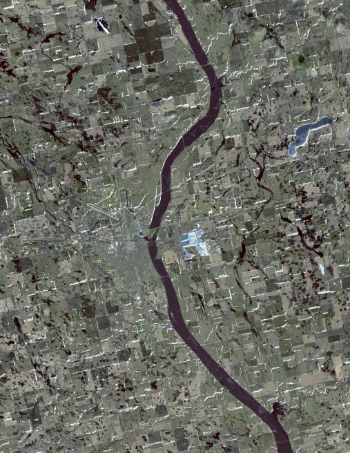
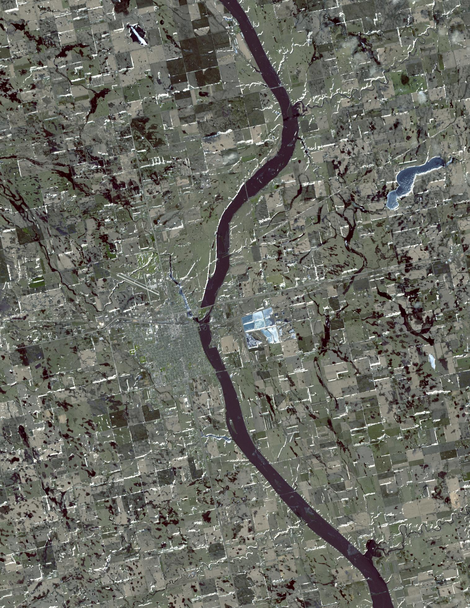
On March 20, 2010, the Advanced Spaceborne Thermal Emission and Reflection Radiometer (ASTER) instrument on NASA's Terra spacecraft captured this simulated natural color image of Huron, South Dakota. Spring melt of the snowpack led to flooding along many rivers in both North and South Dakota. The National Weather Service advised the town of Huron to prepare for flooding of the city by the James River. In this image, frozen lakes and ponds appear blue, bare fields are tan, and fields with minor vegetation are gray-green.
With its 14 spectral bands from the visible to the thermal infrared wavelength region and its high spatial resolution of 15 to 90 meters (about 50 to 300 feet), ASTER images Earth to map and monitor the changing surface of our planet. ASTER is one of five Earth-observing instruments launched December 18, 1999, on NASA's Terra. The instrument was built by Japan's Ministry of Economy, Trade and Industry. A joint U.S./Japan science team is responsible for validation and calibration of the instrument and the data products.
The broad spectral coverage and high spectral resolution of ASTER provides scientists in numerous disciplines with critical information for surface mapping and monitoring of dynamic conditions and temporal change. Example applications are: monitoring glacial advances and retreats; monitoring potentially active volcanoes; identifying crop stress; determining cloud morphology and physical properties; wetlands evaluation; thermal pollution monitoring; coral reef degradation; surface temperature mapping of soils and geology; and measuring surface heat balance.
The U.S. science team is located at NASA's Jet Propulsion Laboratory, Pasadena, Calif. The Terra mission is part of NASA's Science Mission Directorate, Washington, D.C.
More information about ASTER is available at http://asterweb.jpl.nasa.gov/.
Image acquired: March 20, 2010
Area covered: 22.7 by 28.5 kilometers (14.1 by 17.7 miles)
Location of image: 44.2 degrees North latitude, 98.2 degrees West longitude
Image resolution: 15 meters (50 feet)