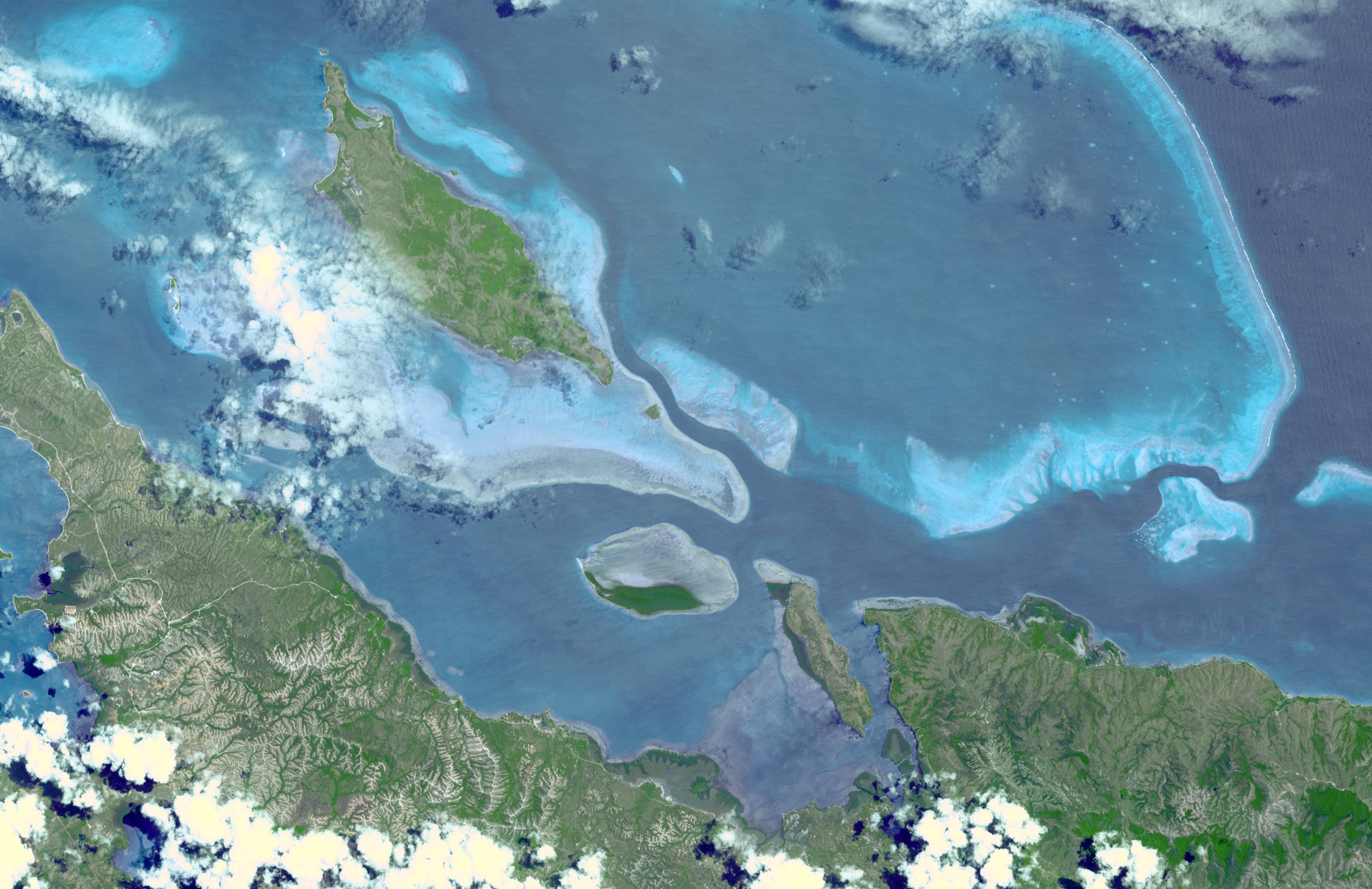
In 2008, UNESCO added the Lagoons of New Caledonia to the World Heritage Site list. This serial site comprises six marine clusters that represent the main diversity of coral reefs and associated ecosystems in the French Pacific Ocean archipelago of New Caledonia and one of the three most extensive reef systems in the world. These Lagoons are of exceptional natural beauty. They feature a remarkable diversity of coral and fish species and a continuum of habitats from mangroves to seagrasses with the world's most diverse concentration of reef structures. The Lagoons of New Caledonia display intact ecosystems, with healthy populations of large predators, and a great number and diversity of big fish. They provide habitat to a number of emblematic or threatened marine species such as turtles, whales or dugongs whose population here is the third largest in the world. The image was acquired August 23, 2003, covers an area of 28.3 x 43.7 km, and is located at 20.2 degrees south latitude, 164.2 degrees east longitude.
With its 14 spectral bands from the visible to the thermal infrared wavelength region and its high spatial resolution of 15 to 90 meters (about 50 to 300 feet), ASTER images Earth to map and monitor the changing surface of our planet. ASTER is one of five Earth-observing instruments launched December 18, 1999, on NASA's Terra. The instrument was built by Japan's Ministry of Economy, Trade and Industry. A joint U.S./Japan science team is responsible for validation and calibration of the instrument and the data products.
The broad spectral coverage and high spectral resolution of ASTER provides scientists in numerous disciplines with critical information for surface mapping and monitoring of dynamic conditions and temporal change. Example applications are: monitoring glacial advances and retreats; monitoring potentially active volcanoes; identifying crop stress; determining cloud morphology and physical properties; wetlands evaluation; thermal pollution monitoring; coral reef degradation; surface temperature mapping of soils and geology; and measuring surface heat balance.
The U.S. science team is located at NASA's Jet Propulsion Laboratory, Pasadena, Calif. The Terra mission is part of NASA's Science Mission Directorate, Washington, D.C.
More information about ASTER is available at http://asterweb.jpl.nasa.gov/.
